Nelson Falls

Half an hour from Queenstown, along the Lyell Highway, we parked at the start of the Nelson Falls Nature Trail. The falls are located within the Franklin-Gordon Wild Rivers National Park, four and a half thousand square kilometres of World Heritage listed wilderness. It’s an easy walk along a well maintained track

1.Nelson Falls Nature Trail

that follows the course of the Nelson River.

2.Nelson River3.Nelson River

Majestic forest trees edge the path,

4.Nelson Falls Nature Trail

ancient species including myrtle, leatherwood and sassafras that thrive in the cool, temperate climate of the Nelson Valley.

5.forest

I’m not sure what happened here, perhaps a glitch in the camera that hasn’t happened before or since. Or has the lens captured the magic of the place?

8.magic

The ferns are magnificent, at least seven species flourish here dating back millions of years to a time when Tasmania was part of Gondwana.

9.ferns

At the end of a summer, the 30 metre high falls were still impressive.

10.Nelson Falls11.Nelson Falls12.Nelson Falls

I like the description of being shaped like an inverted wine glass.

13.Nelson Falls

The water was so clear,

14.Nelson River

we could see freshwater burrowing crayfish foraging among the rocks.

17.Freshwater Burrowing Crayfish

I noticed they had one claw smaller than the other. Apparently, this can happen naturally or it is the result of losing a claw and a new one regrows. Fascinating.

We retraced our steps along the river, leaving the coolness of the forest to continue our journey on the highway.

18.Nelson River19.Nelson River

Yarra vines

After the challenge of negotiating Melbourne peak hour gridlock, our tension slipped away as the traffic quelled and the road bisected a quilted landscape of farmland and vineyards. The Yarra Valley is renowned for its abundance of wineries and award winning wines. It seems June is the time of year to shorten opening hours to ‘winter time’ or to close doors and concentrate on maintenance but  De Bortoli didn’t let us down.

1.DeBortoli

The family company spans four generations, established by Vittorio and Giuseppina who migrated from Italy in 1928 to settle in Bilbul, New South Wales.  The Yarra Valley Estate was purchased in 1987, the original plantings of 1971 make it one of the oldest vineyards in the Yarra Valley. The bespoke rustic gates at the entrance to the property open to a tree-lined driveway, the morning sun still low in the sky.

2.bespoke gate3.DeBortoli driveway

The Locale Restaurant upstairs serves authentic Italian dishes made with ingredients grown on the estate.

4.restaurant & cellar door

Too early for lunch, we made our way to the cellar door instead.

5.cellar door

The space was warm and welcoming with interesting presentations of products.

There are a few tasting options, including a specialty gourmet selection combined with a cheese platter

8.cellar door

and private Trophy Room Tastings for those wanting to learn more about De Bortoli Italian wines.

9.Trophy Room10.Trophy Room

We opted for a tasting at the counter, the friendly staff happy to share their knowledge. A bottle of La Boheme, Act 1 Riesling accompanied us on our journey to enjoy later. The view is spectacular, 162 hectares of vines merge with rolling hills and distant ranges.

11.view from cellar door

We retraced our tracks to Yarra Glen for a life sustaining sausage roll at the bakery before continuing on to our next point of call. Zonzo Estate is set on 230 acres with stunning views across the valley.

12.view from Zonzo13.view from Zonzo

The 45 acres of vines were pruned and ready for spring,

14.vines

a comfortable perch for the local aves

15.raven

and the young olive trees were bearing fruit.

16.olives

We were disappointed to find the cellar door locked and deserted

17.Zonzo cellar door

but we had a quick nosey around. The old farm buildings have been cleverly resurrected and are a popular venue for weddings. I’d be happy just to sit with a glass of wine and absorb the wonderful vista.

18.Zonzo Estate

Kilmainham Gaol

A suitably gloomy Dublin day accompanied our visit to Kilmainham Gaol, a prison built in 1796 and remembered for the incarceration and executions of the leaders of the 1916 Easter Rising. Decommissioned in 1924, the property was left deserted and neglected until 1960 when volunteers set about restoring the site to preserve it as a museum.

1.Kilmainham Gaol entrance

Above the entrance, a carving of five serpents in chains represents the five most heinous crimes: rape, murder, theft, piracy and treason.

2.Five serpents in chains above entrance

The restoration was completed in 1971 with the re-opening of the chapel after reconstruction of the altar. One of the leaders of the Easter Rising, Joseph Plunkett, married his fiancé Grace Gifford in the chapel just hours before he was executed.

3.Chapel

The West Wing is the oldest part of the gaol, the corridors are long, dark and cold.

4.West Wing5.West Wing

The limestone walls gave no insulation and the windows had no panes, an attempt to reduce the incidence of disease with the flow of fresh air.

Poor health and hygiene was inevitable with five prisoners sharing a cell built for one. There was no segregation between men, women and children and a single candle provided the only light and had to last two weeks.

9.cell

An inscription has been scratched by a former prisoner over a doorway , “beware of the risen people that have harried and held, Ye that have bullied and bribed”. The quote is from the poem, The Rebel by Patrick Pearse, one of the authors of the Irish Proclamation of Freedom and a leader of the Easter Rising.

10.Padraig Pearse quote

The Great Famine contributed immensely to the problem of overcrowding in the West Wing with more people found guilty of stealing food and those committing crimes deliberately so they would at least be fed regularly. Adding to the numbers were convicts awaiting transportation to Australia and people with mental illnesses.

11.West Wing

The situation was alleviated somewhat in 1862 with the opening of an additional ninety six cells in the new East Wing. The Victorian era brought different ideas on the reform of inmates and the new addition was more open and much lighter.

12.East Wing Main Hall13.East Wing16.East Wing

The cells didn’t seem to be any bigger but definitely less draughty, a bonus for the men who were moved to the East Wing. The women stayed behind in the dark, cold cells of the West.

With the new wing came exercise yards where the prisoners spent one hour a day, silently walking in a circle. Another hour was spent in church and the remaining 22 hours confined to their cells.

19.exercise yard East Wing20.exercise yard East Wing21.exercise yard East Wing

The Stonebreakers’ Yard was stunningly silent, a palpable ominosity hung in the air. Between May 3rd and May 12th 1916, fourteen men, leaders of the Easter Rising, were executed by a British firing squad. The first was Patrick Pearse, a cross marks the ground where he and the next twelve died.

22.Cross marking the place of execution of the leaders of the 1916 Rising

James Connolly was the last. He had been badly wounded in the uprising and, even though he only had a day or two to live, was brought to the courtyard on a stretcher, through the gate.

23.Stonebreakers' Yard gate where ambulance brought James Connolly

Unable to stand, instead of being marched to the other end of the yard for execution, he was tied to a chair and shot. A second cross marks the spot where he died.

24.Cross marking the place of execution of James Connolly

It seems fitting that the Irish tricolour flies between these two crosses, a symbol of the independence these men fought so hard for.

25.Irish tricolour between crosses in Stonebreakers' Yard

Barga

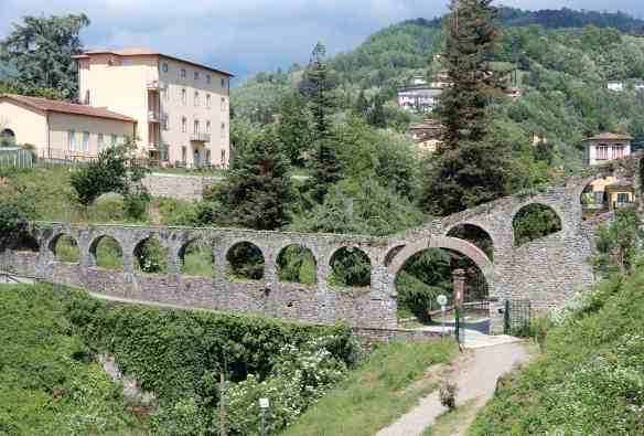
On a perfect sunny spring day, we drove to the medieval walled town of Barga, an easy 45 minute drive from Lucca. We had learned it was easier to park outside these ancient towns and walk in rather than risk inadvertently driving into a pedestrian zone or the wrong way down a one way street. Crossing the bridge, we passed Parco Fratelli Kennedy, named in honour of American President John F. Kennedy and his brother Robert, both of whom were assassinated.

1.Parco Kennedy

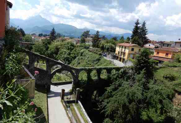
The old stone aqueduct was built in the 15th century to supply clean water for the fountains and crosses the original moat of the old village.

1a.aqueduct Parco Kennedy

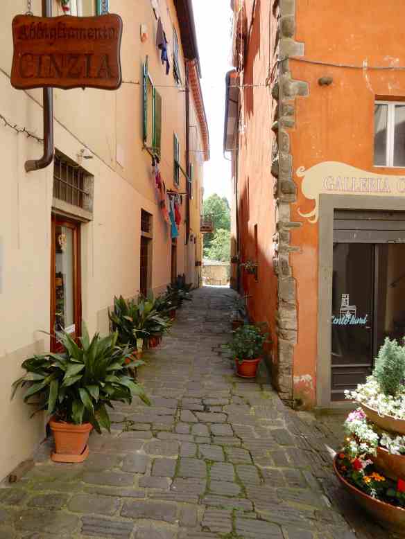
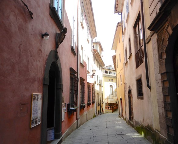
Narrow streets and steep steps hinted at what was to come once we were inside the walls.

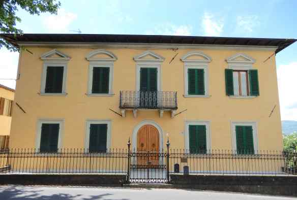
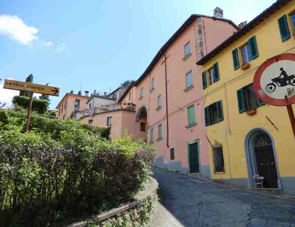
Beautiful buildings lined the main thoroughfare

4.beautiful building

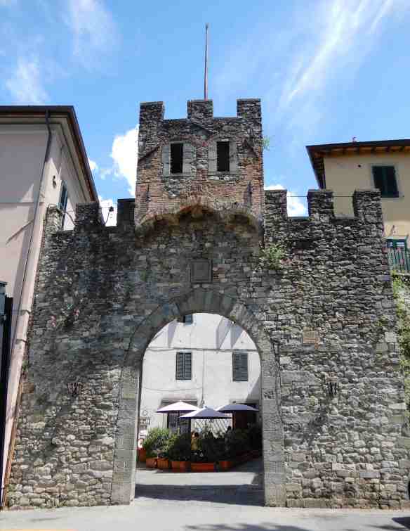
as we made our way to Porta Reale, one of the three gates in the medieval city walls. Below the observation tower, the gate still displays the ancient coat of arms of the city.

5.Porta Reale

The layout of the town has remained virtually unchanged since the 8th century, buildings at impossible angles hug narrow lanes, mysterious alleyways and stone steps.

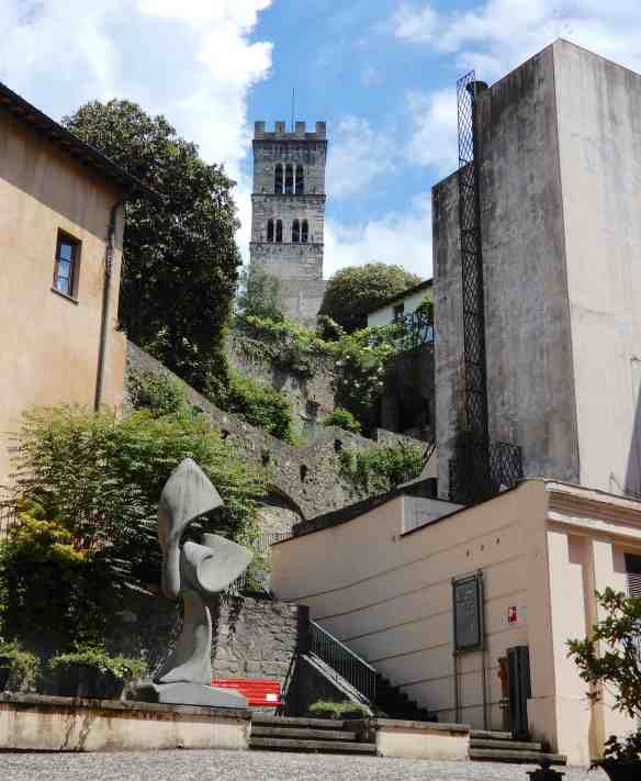
We set off through the web of streets with no real destination in mind, happy to amble randomly in the sunshine. An interesting sculpture caught our eye

10.sculpture

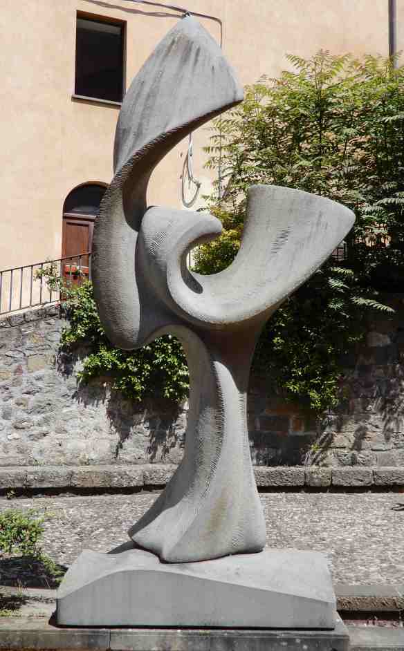
outside the Teatro dei Differenti, Barga’s main theatre. Constructed in 1668 it was deemed too small at the end of the 18th century, a new structure was built on top of the old one.

11.Teatro dei Differenti

Along with the theatre, the adjacent buildings have been beautifully restored.

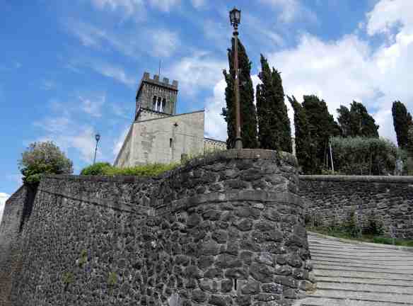
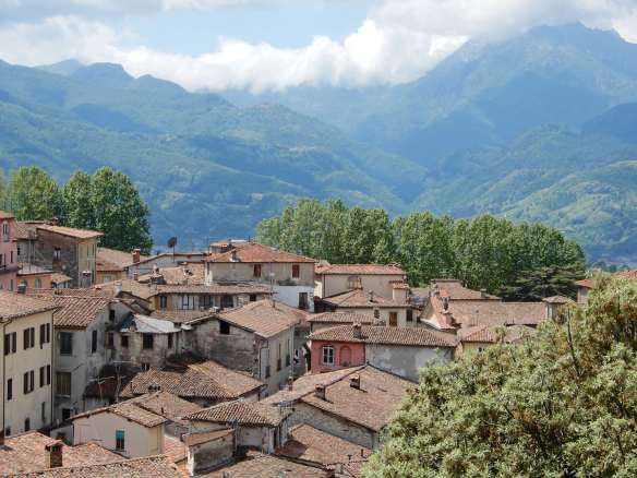
We decided to head to the highest point in the town once we spotted the bell tower of the Duomo di San Cristoforo.

14.Duomo di San Cristoforo

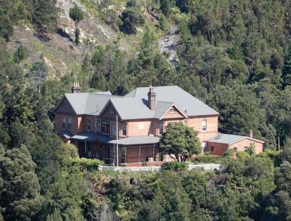
Our quest took us past the immaculate garden of the Palazzo Salvi,

15.Palazzo Salvi16.Giardino di Palazzo Salvi

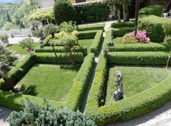
less opulent but equally interesting plots

17.garden

and the myriad doorways we had come to expect.

We finally reached the cathedral, a spectacular edifice that I will need to cover in a separate post.

30.Duomo di San Cristoforo

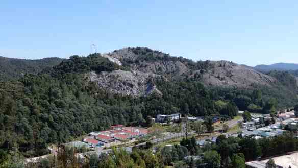
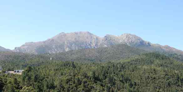
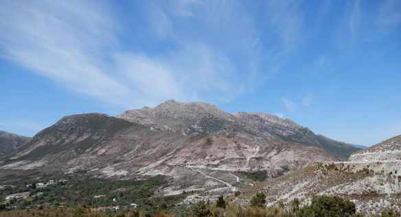
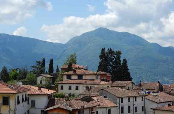
The views across the rooftops to the Apuan Alps and the shrouded peak of Pania della Croce were stunning.

31.view

33a.view

Tearing ourselves away, we meandered back to town in search of sustenance, discovering a memorial garden in Piazza Garibaldi, adjacent to the Museum of Memory. A large sculpture entitled La Vedette (in military terms meaning the forward observer) was unveiled in 2009 on the 4th November, a day celebrated in Italy as the anniversary of the end of  World War I.

We reached Piazza Angelio at lunch time, a popular place in summer for exhibitions and entertainment. The particular shape and almost perfect acoustics of the piazza make an ideal setting for international festivals such as “Opera Barga” and “Barga Jazz”.

16th century poet Pietro Angeli, nicknamed Bargeo, watches over the piazza from the corner of Palazzo Angeli.

The offerings on the blackboard at L’Osteria enticed us in, we weren’t disappointed.

41.L'Osteria

With much of the town still to see, we continued our wanderings in a different direction.

45.narrow street

Colourful homes lined the street

48.colourful houses

and some clung precariously to the edge of the cliff.

49.fabulous homes

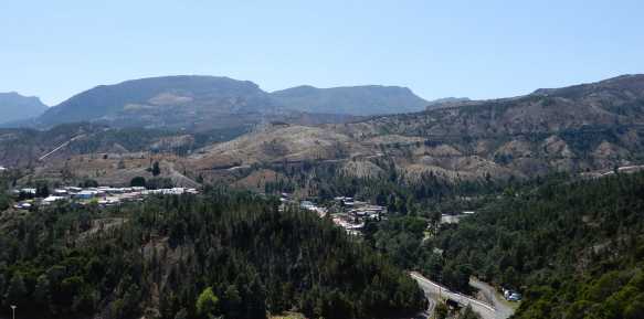
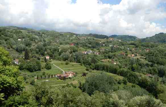
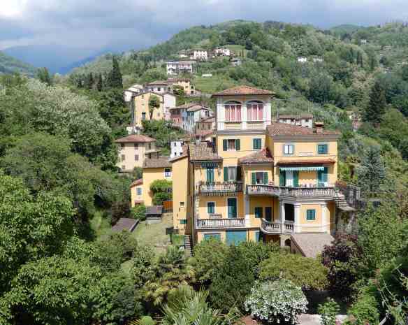
All had magnificent views of neighbouring hilltop towns and verdant countryside.

50.hilltop town51.views

The aqueduct and Kennedy Park were behind us

52.aqueduct

as the outskirts of town stretched in front.

53.Villa Buenos Aires

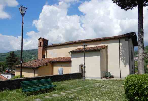
The 17th century Chiesa di San Felice, was quite small and understated when compared to others we had seen on our travels.

54.Chiesa di San Felice55.Chiesa di San Felice

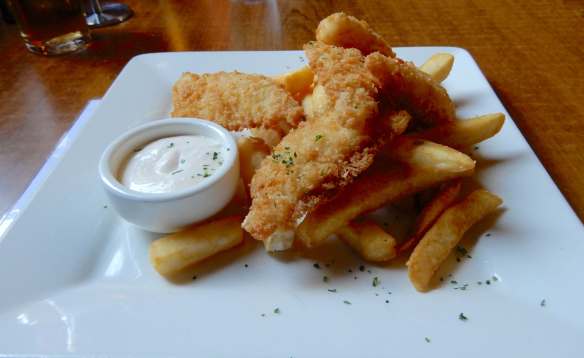
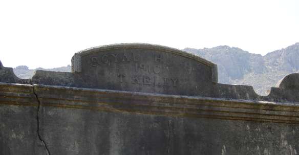
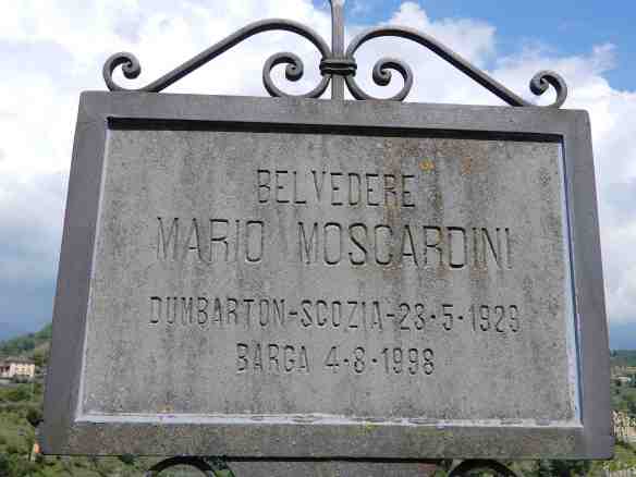
Outside the church was this memorial plaque, apparently dedicated to a Scotsman with an Italian name. It seems Barga has a strong connection to Scotland, with many residents emigrating there in the 19th century in search of work when industry in Tuscany suffered a decline. They won the Scots over with their gelato making skills and, coupled with a knack for cooking fish and chips, made great success out of their cafés and restaurants. Over the generations, some returned to Barga and now sixty percent of the town’s 10,000 residents have Scottish relations. The annual Festival of Fish and Chips, Sagra del Pesce e Patate, celebrates this connection for three weeks each July/August. I can’t find any clues as to the life of Mario Moscardini but I assume he made a considerable contribution to Barga.

61.memorial

Working our way along Via di Mezzo, we found an interesting little face peering out from the wall of a restaurant. It is known as a scacciaguai, a folk magic figure that protects from trouble and harm. Hopefully, the charm has worked for the restaurant of the same name.

62.scacciaguai

Three doors along, we paid a visit to Casa Cordati, a 17th century palazzo that was once the studio of local artist Bruno Cordati.

63.Casa Cordati

It is now owned by his grandson, Giordano, and offers rather sumptuous accommodation as well as an extensive gallery on the first floor. The rooms on this floor have been preserved as they were during Bruno Cordati’s creative years, the views were nothing short of inspirational.

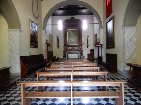
Our exploration of this magical town had come to an end as we reached the Piazza della Santissima Annunziata and the 16th century church of the same name. The 19th century façade was badly damaged by artillery shells in World War II and was later restored.

72.Piazza della Santissima Annunziata

There was only one thing left to do to make the day complete.

73.gelati

Queenstown

Queenstown has always been one of those places we passed through on our way to somewhere else. The first time was on holiday in 1998, the barren terrain and torrential deluge didn’t entice us to linger. The largest town on Tasmania’s west coast has changed considerably since then. The early 1900s saw mass logging as the mining town boomed and the expansion of the copper mines left an eerie, lunar landscape bereft of vegetation. The main street is reminiscent of a wild west movie set with Mount Owen towering above re-forested hillsides.

1.Orr Street

We made our way to Spion Kopf Lookout for a different perspective of the town. Tasmania was one of the first British colonies to send volunteers when the second Boer War broke out in 1899. The British suffered a humiliating defeat on a hill in Natal called Spion Kopf, meaning ‘Spy Hill’, and on returning home, the British survivors named stands at their local football grounds ‘the Kop’ to commemorate the fallen. I don’t know if Queenstown had a football ground, but this hill was named for the same reason. There is a poppet head made from materials from the old mine

2.poppet head

as well as a restored cannon, one of two cast at the Queenstown smelters in 1898.

3.cannon

The second cannon was transported to Victoria in 1910 where it was used to fire the royal salute on the coronation of King George V. It was used again in 1918 to celebrate the end of World War I but, unfortunately, it was overloaded with powder and exploded when it was fired.

4.lookout

From our perch, we had a fabulous view of the rather impressive Penghana, built in 1898 for Mr. Robert Sticht, the General Manager of the Mount Lyell Mining & Railway Company. The home certainly reflects the power of a man in his position  and the wealth in the town at the time. Robert Sticht died in 1922 and ten more general managers and their families lived at Penghana until 1995 when the title was transferred to the National Trust. The house is now run as a unique bed & breakfast, I think we need to find an excuse to stay at Penghana.

5.Penghana Bed & Breakfast

The hills surrounding the town still have some regenerating to do and the isolation is evident from this outlook.

6.lookout view7.lookout view8.Mt. Owen

We returned to ground level for lunch at the Empire Hotel, a beautiful, heritage listed building dating back to 1901.

The lobby is dominated by a stunning hand-carved Tasmanian Blackwood staircase. The raw timber was shipped to England, carved and shipped back to Queenstown.

13.Empire Hotel lobby

The tasteful furnishings echoed the era

15.Empire Hotel lobby

and the traditional dining room had a cosy ambience

16.Dining Room

with a beautifully restored ceiling rose.

17.ceiling rose

The menu was extensive but who can go past fish ‘n’ chips on a Friday?

18.fish & chips

Fortified, we were ready to tackle the ’99 bends’, the infamous road between Queenstown and Gormanston that makes us appreciate the innovation of power steering. As the road straightened, we turned off to Iron Blow Lookout, an extended viewing platform over the former open-cut mine.

19.Iron Blow Lookout

Miners flocked to the area when gold was discovered in 1883 but they found the plentiful copper deposits more profitable. The colours were striking on this sunny day.

20.Iron Blow Lookout

The view across the Linda Valley to Lake Burbury was spectacular,

21.Iron Blow Lookout22.Lake Burbury

while the denuded landscape remains as a legacy from the past.

23.Iron Blow Lookout24.Iron Blow Lookout25.Iron Blow Lookout

The nearby settlements of Gormanston and Linda were built for workers of the Iron Blow but both are now ghost towns. The only evidence of former lives in Linda is the haunting remnants of the Royal Hotel. The original structure burnt down in January 1910 and T Kelly rebuilt using concrete to avert any future disasters. The hotel finally closed in the 1950s and the shell still stands despite more recent flames.

26.Royal Hotel, Linda27.Royal Hotel, Linda

We left the west coast behind as we crossed the bridge over Lake Burbury, uplifted by the afternoon sun glistening on the pristine water.

28.Lake Burbury