Darwin Military Museum

There are many reminders in the Northern Territory of Australia’s involvement in World War II and a visit to Darwin Military Museum gives a fascinating insight into just how close the Japanese invasion came. On 19th February 1942, the Japanese bombed Darwin, killing 252 people, destroying aircraft, sinking 10 ships and severely damaging the township. Over the next 21 months, the Northern Territory was subjected to a further 97 air attacks by the Japanese, including 51 bombing raids.

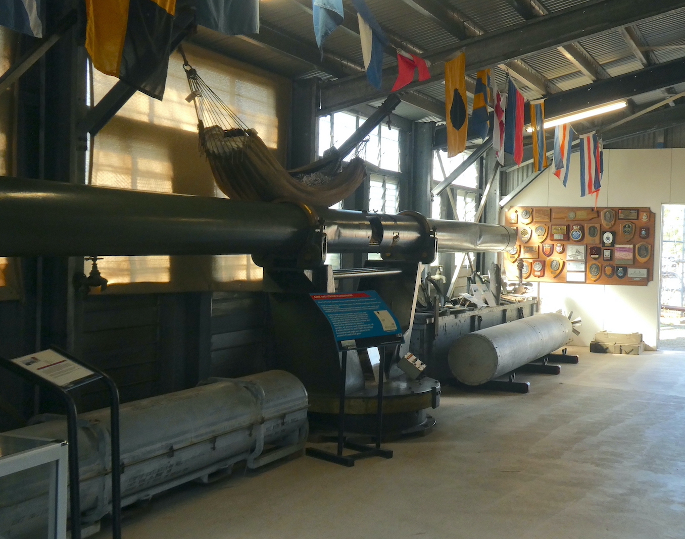
Since the mid-1960s, the Royal Australian Artillery Association has been accumulating war memorabilia and the vast collection includes artefacts from the Boer War to the present day. Once past the entrance display,

I realised there were far too many intriguing items to photograph, not least this painted feather. The MV Manunda was launched in 1929 as a passenger liner and souvenirs of voyages, such as this, were common. The vessel became HMAS Manunda and served as a hospital ship during World War II before returning to civilian life in 1946. Ten years later, in an ironic twist of fate, she was sold to a Japanese Shipping Company, broken up and used for scrap.

We continued our exploration outside, where larger artillery pieces and military vehicles are scattered through tropical gardens and various outbuildings. A memorial to the Australian Digger stands adjacent to one dedicated to Gunner, a kelpie credited with the ability to alert his squadron when Japanese aircraft were approaching.

The sheer scale of some of the exhibits is boggling, it is difficult to fathom the logistics of deploying this equipment in the field. Boom net buoys were used to suspend the huge cable for the anti-submarine net stretched across Darwin Harbour. For added security, a massive metal detecting loop was laid on the floor of the harbour to detect any submarine activity.

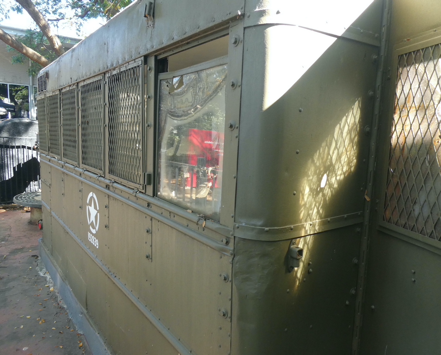
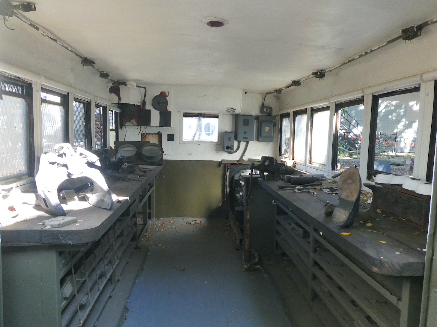
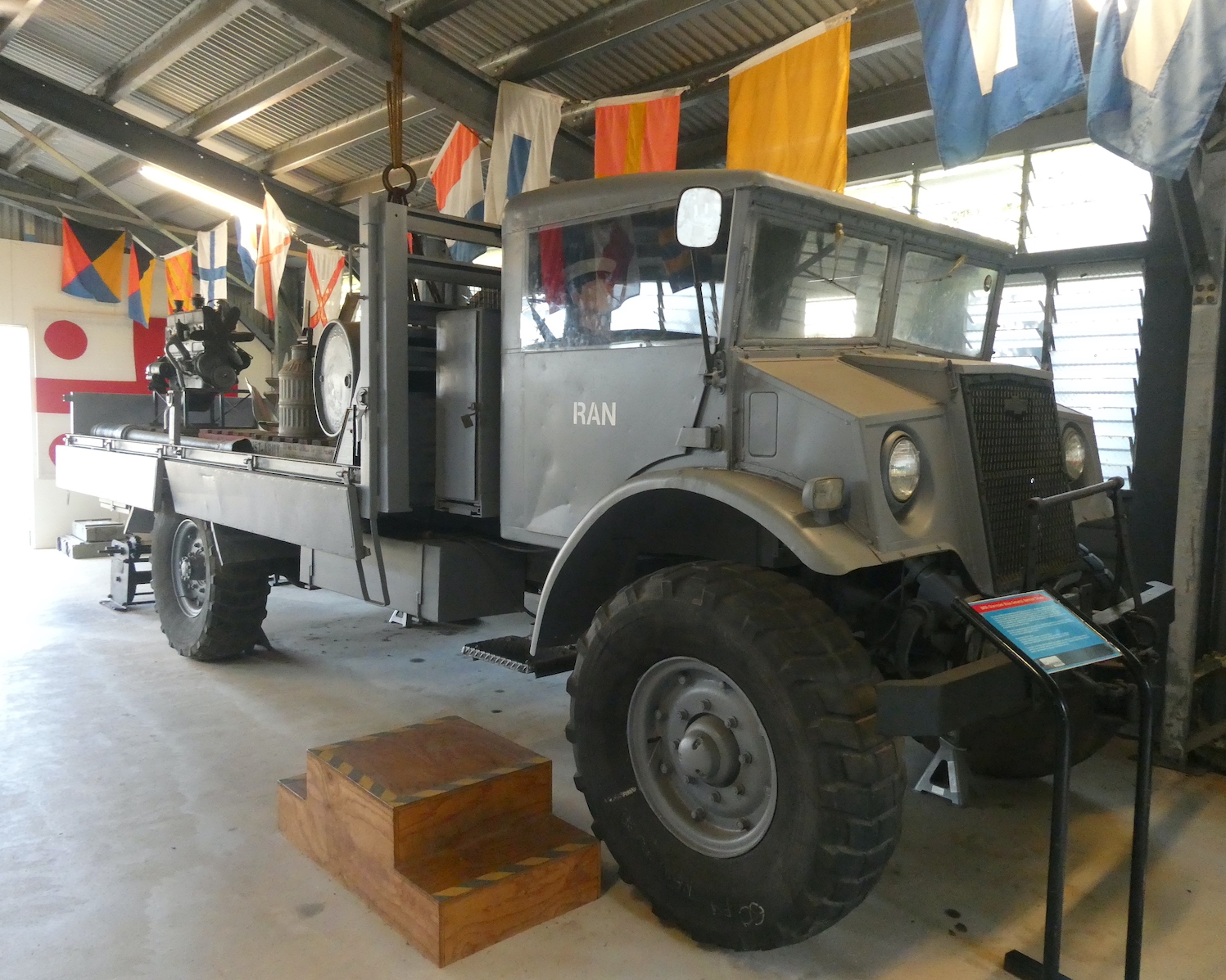
Vehicle-mounted workshops were primarily used for maintenance in the field, with small engines under the bench to run electrical items such as grinders and compressors.

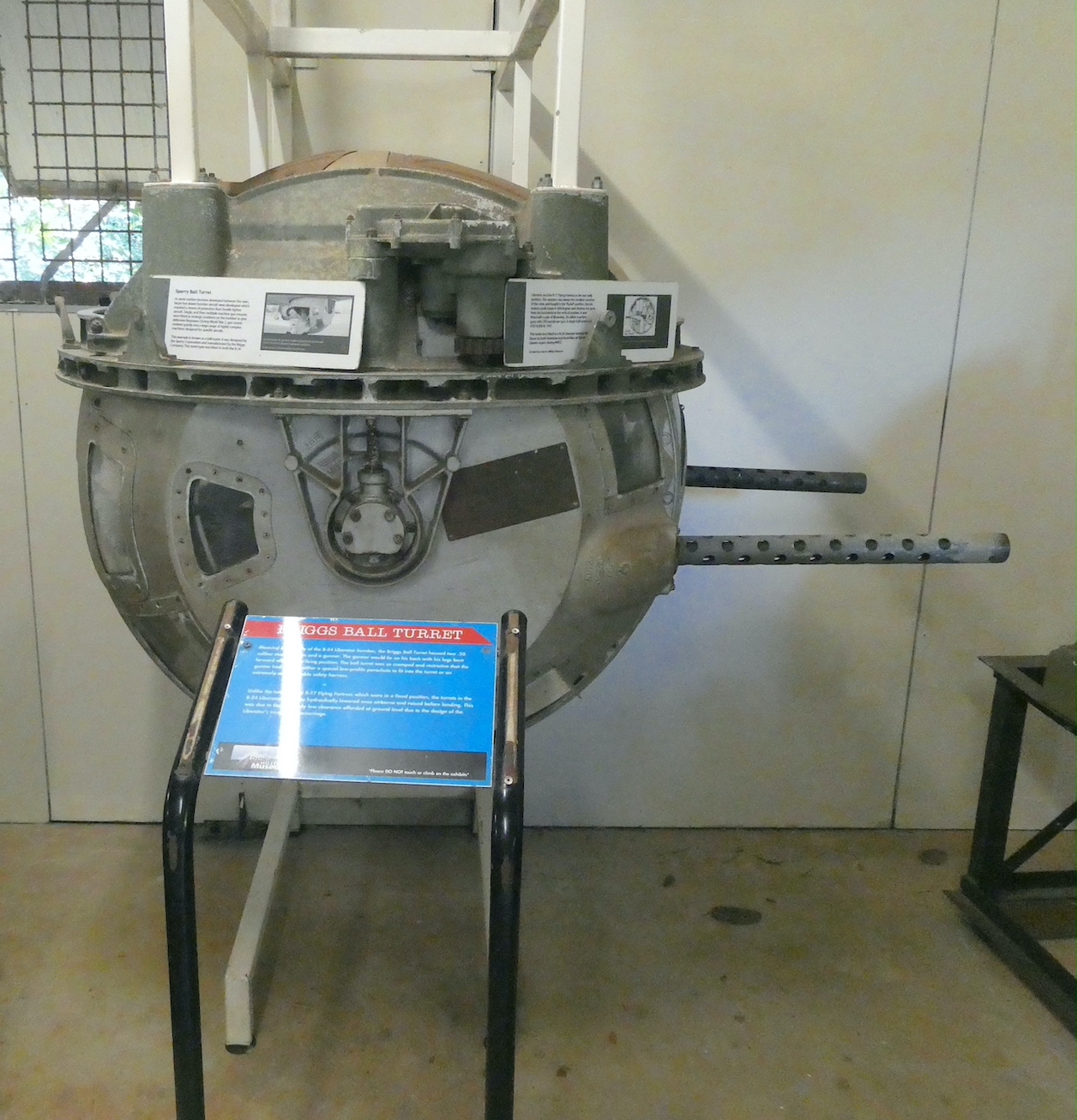
Probably the most terrifying place to be on the fighter planes was the ball gun turret. Suspended underneath the aircraft, the gunner, usually the smallest man in the crew, had to assume a foetal-like position on missions of up to ten hours.

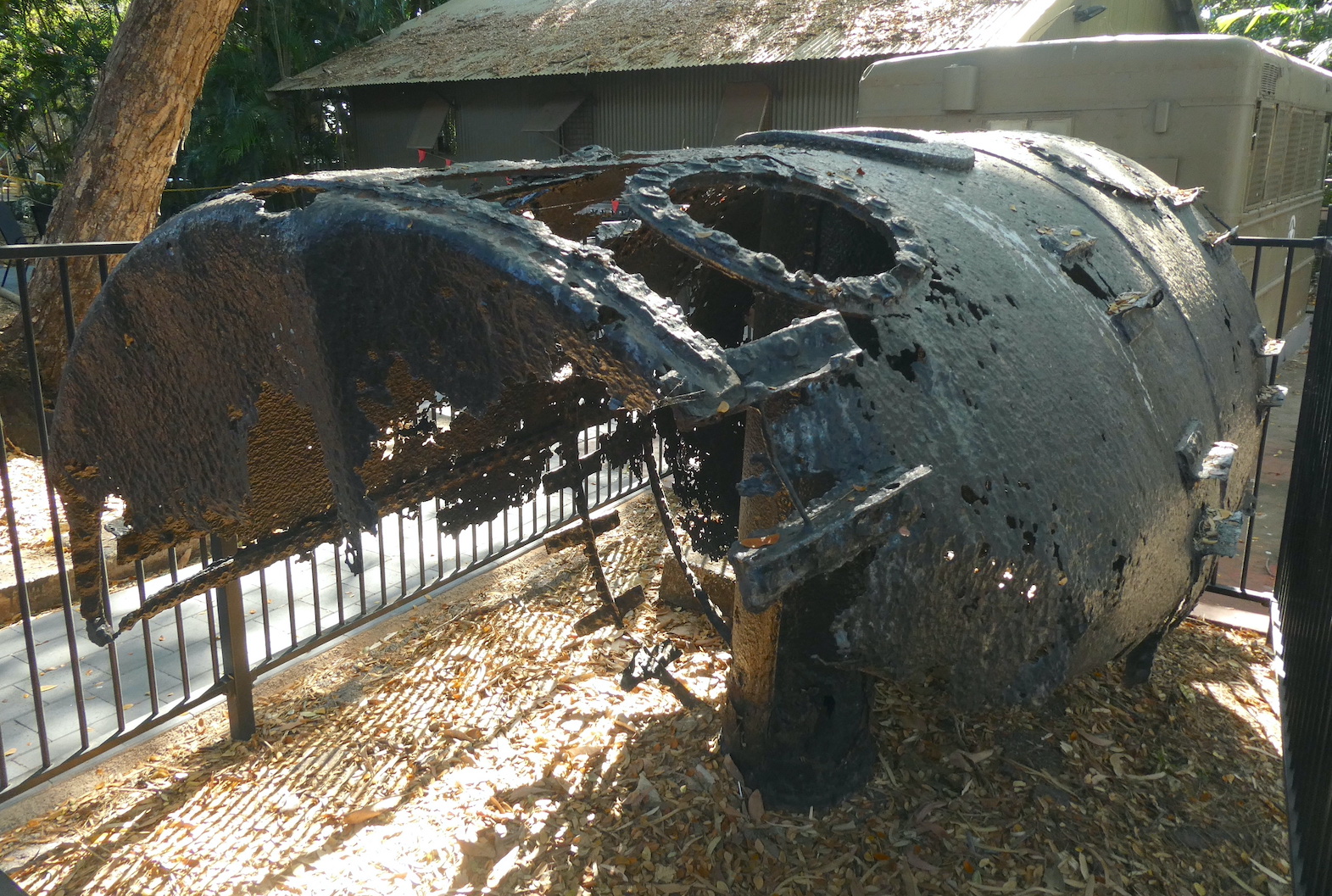
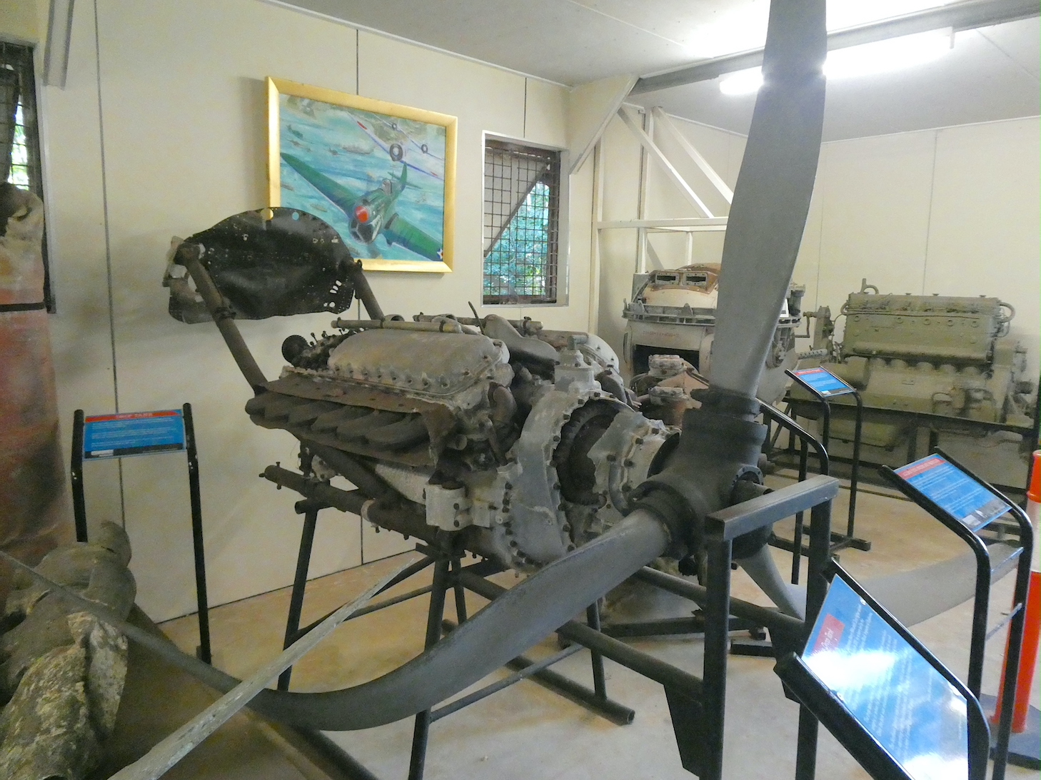
Some remnants of wartime are still being found in the N.T., like this Japanese drop tank. The tanks carried extra fuel to extend the range of the aircraft and, once empty, could be released to reduce drag in combat situations.

There are several engines and propellors on display, each with their own story. This one separated from the fuselage of a Kittyhawk during a forced landing in 1942. Fortunately, the pilot survived.

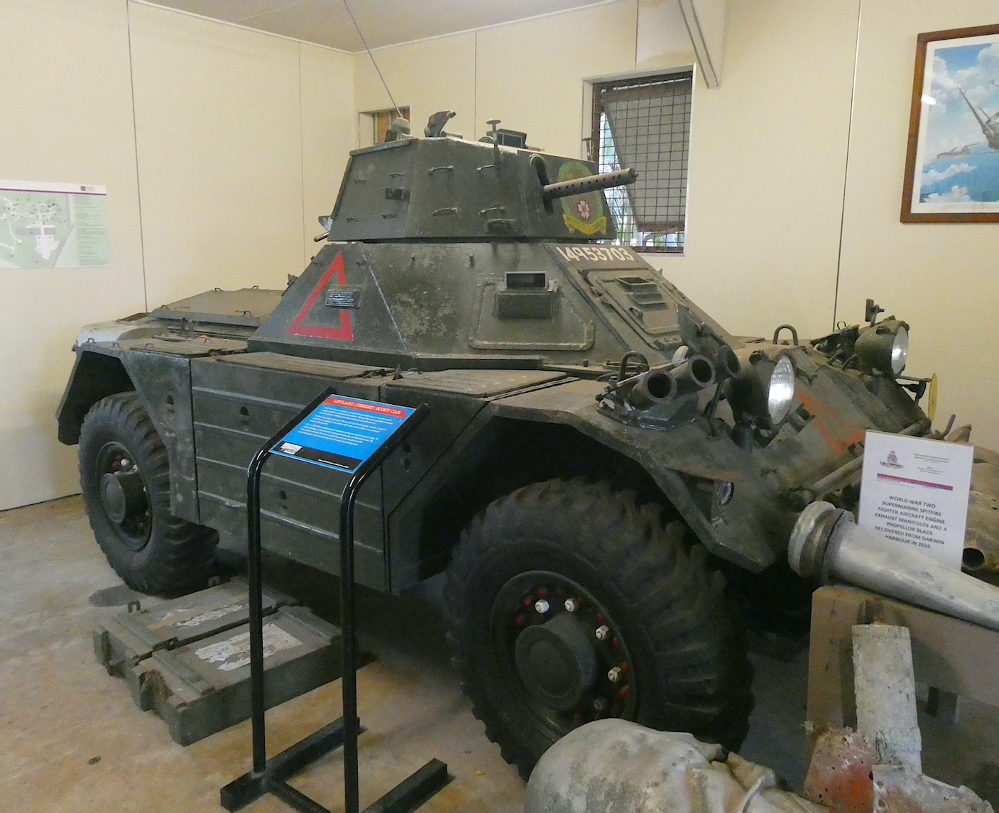
Almost as uncomfortable as the ball turret, two personnel would be squeezed into the hot, noisy cabin of the Ferret scout car. One would drive and the other would man the machine gun and grenade launchers.

On a much larger scale, the Buffalo was used as an amphibious transport vehicle, though its design meant it could only operate in the calmest of seas without taking on too much water.

Looking suspiciously like a missile, paravanes were actually used in minesweeping operations. With a cutting cable attached, they were dragged behind a minesweeper at a pre-determined depth and, once the enemy mine was located and detached, it was destroyed by small-arms fire. Sometimes the paravane received collateral damage.

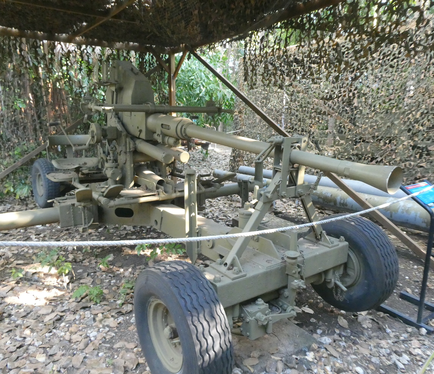
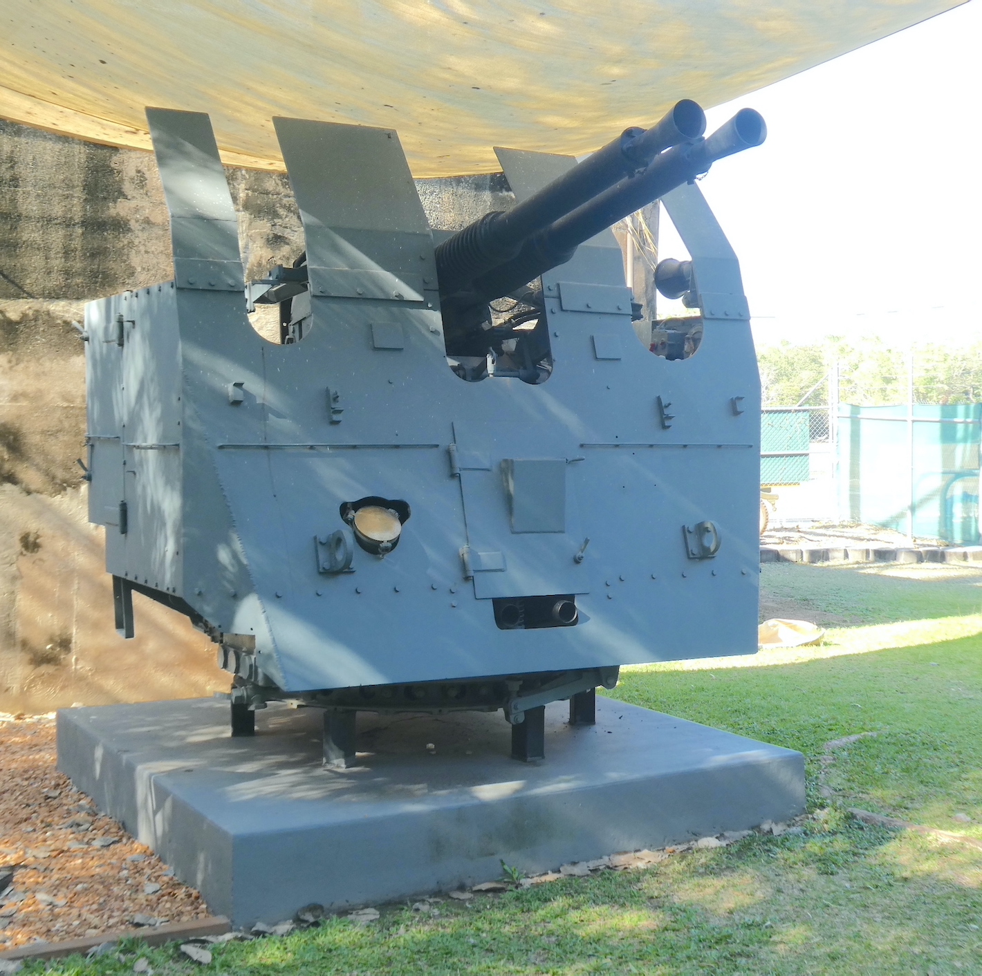
The big guns were just around the corner, an impressive collection of field and anti-aircraft guns, all of which must have been onerous to manoeuvre in battle.

Knowing where to aim the artillery pieces was a little more complicated than it is these days. A rangefinder was used to determine the angle and distance to the target, this one is the largest in the world and was installed at the East Point gun emplacements.

The information was then passed via telephone to the plotters manning the ‘fire direction table’ where they computed such things as wind speed, air pressure, humidity and temperature, all of which affected the shell’s flight.

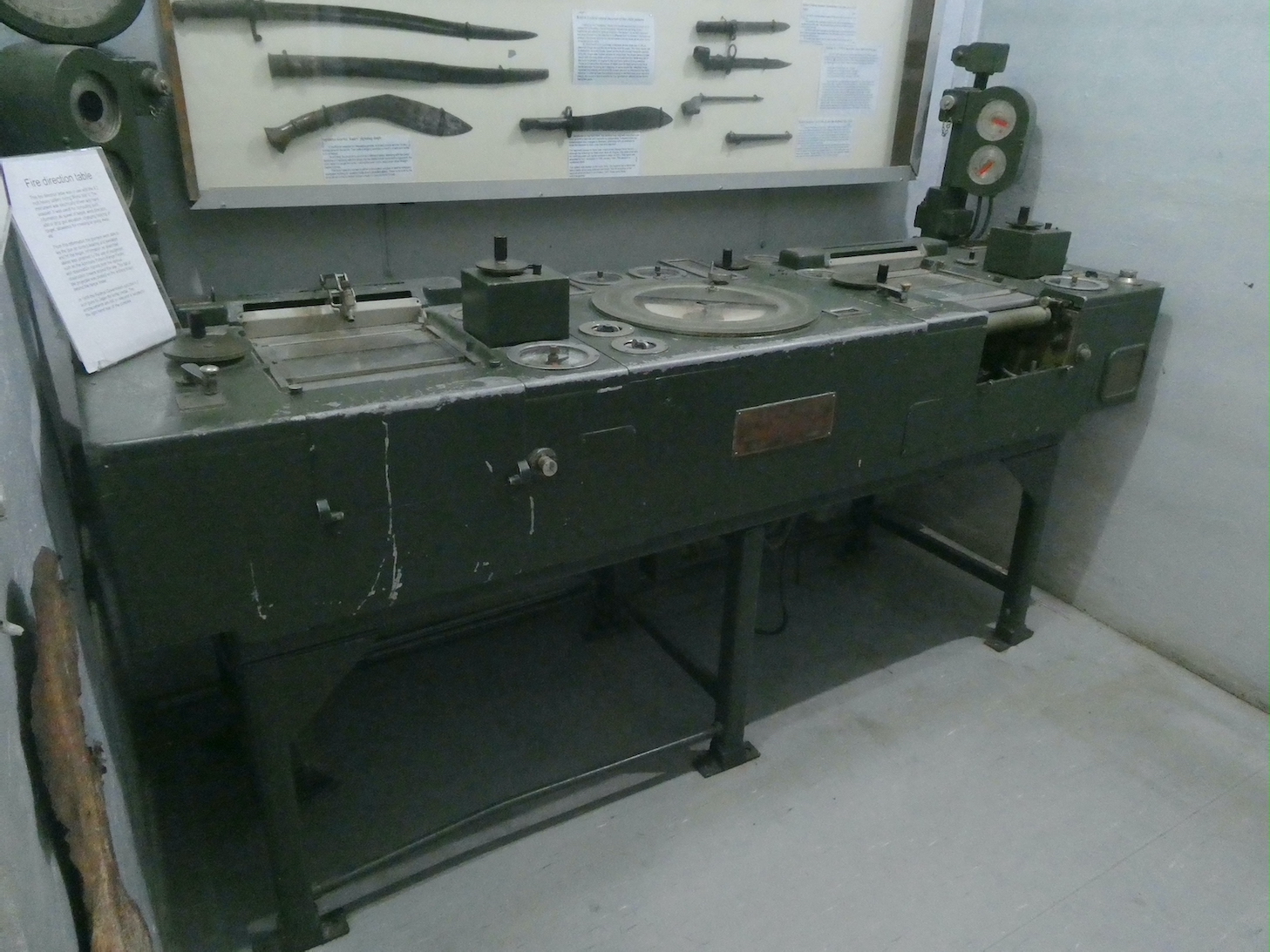
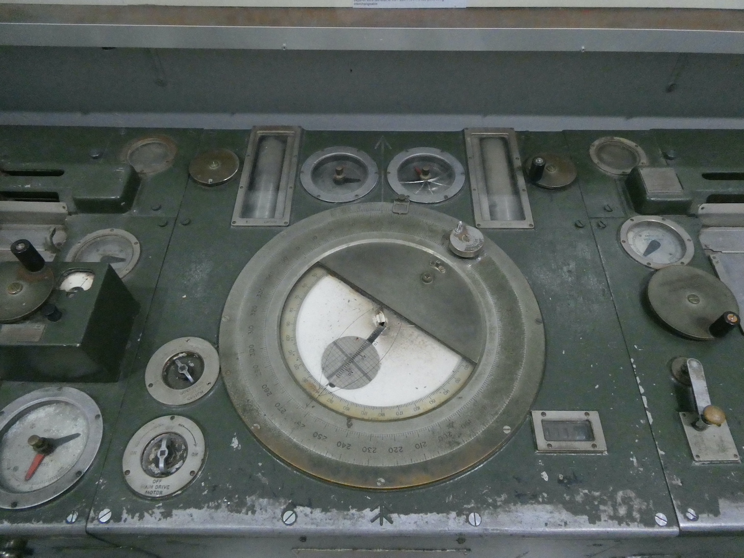
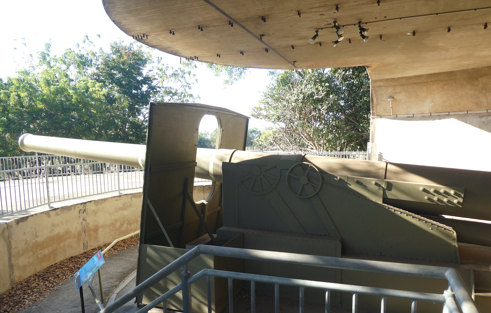
The gunners were then able to set the correct bearing and elevation to hit the target. The initial 6” guns were replaced by two 9.2” guns but they didn’t arrive until February 1944. Consequently, the only rounds fired from these were three proof rounds, the war ended and, in 1959, both guns were sold to a Japanese salvage firm and cut up for scrap metal. The replicas that now stand on the site are quite impressive.

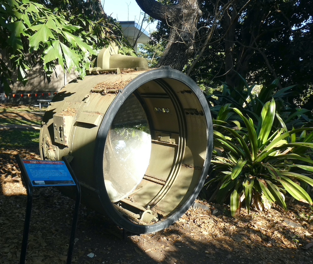
Operating in conjunction with the rangefinder crews, massive searchlights with a range around 25 kilometres were used to spot enemy ships.

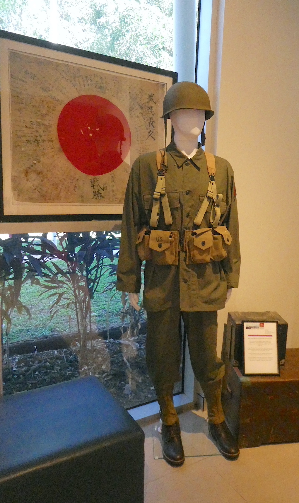
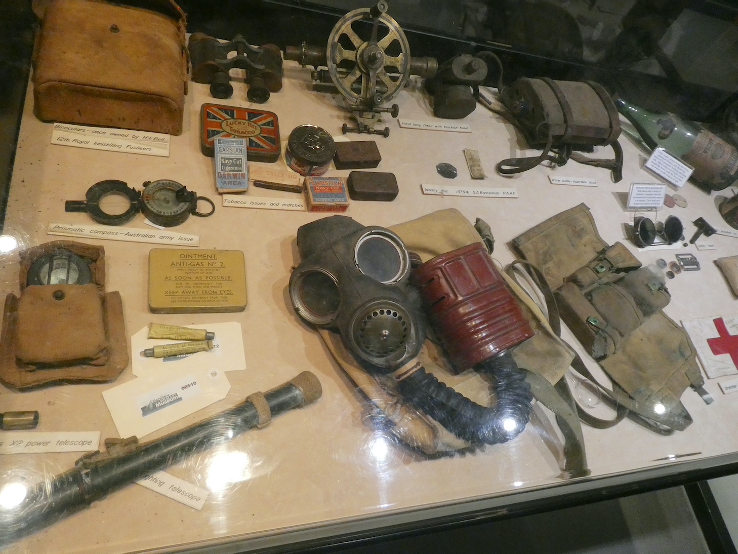
There are many displays of assorted paraphernalia

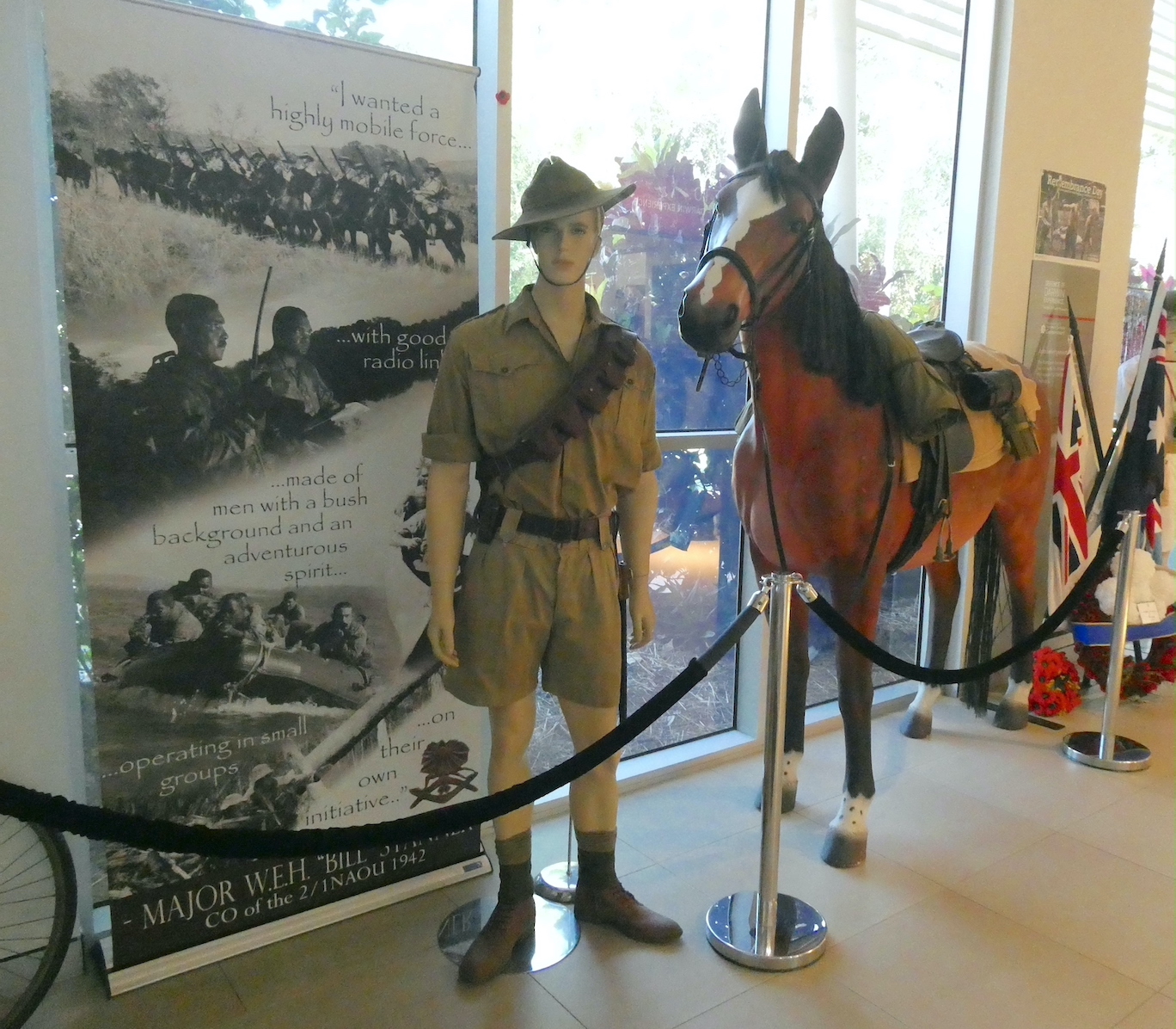
and a tribute to the military horse troops. Around 1500 horses and men of the North Australia Observation Unit, known as Nackeroos, were stationed in remote locations to watch for enemy activity.

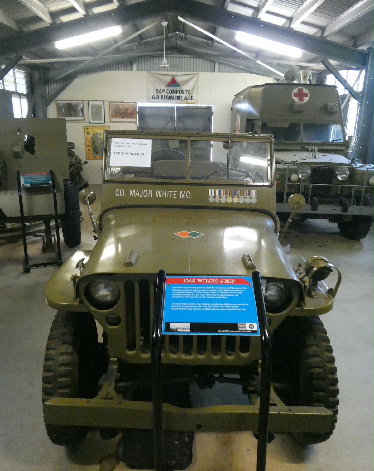
The final outbuilding contained a wonderful array of service vehicles from trucks to Bren Gun carriers.

The most recognisable is the 1942 Willys Jeep. Originally designated a ‘Vehicle General Purpose’ or ’Vehicle GP’, the name resulted in the term ‘jeep’. Willys were the original designers and manufacturers of the Jeep and then contracted the building of them to Ford.

If you are planning a visit to the museum, allow plenty of time, there was so much more to see.

Enchanted Walk

There are many wondrous walks to choose from in Cradle Mountain National Park but my favourite is Enchanted Walk. Just over one kilometre long, the circuit takes around twenty minutes, depending on how much time one spends admiring the scenery. The trail starts at Cradle Mountain Lodge and follows Pencil Pine Creek as it bubbles along, embraced by mossy banks and majestic trees of the rainforest. On this morning the sunlight danced on the water, highlighting natures artistry.

Tannins from surrounding buttongrass moorland created a startling palette of orange hues amidst the shadows.

As we meandered further into the forest, verdant lichens complemented the russet glow.

At the end of the walk, the creek tumbles over rocks at Pencil Pine Cascades on its way to Pencil Pine Falls and, eventually, on a convoluted journey into the Forth River and Bass Strait.

north to south

I had assumed our journey from the North Island to the South Island of New Zealand would be in a north-south direction. In actuality, the crossing of Cook Strait is from east to west. Named after Captain James Cook, who first mapped it in 1773, the waters of the strait are considered among the most dangerous and unpredictable in the world. The regular ferry service is often disrupted due to rough water and heavy swells from strong winds. Fortunately, our early morning sailing from Wellington was on a sea of glass.

About half of the 70 kilometre voyage is in the strait before entering the spectacular Marlborough Sounds.

Many of the small settlements, surrounded by steep, wooded hills, are only accessible by boat.

With 1500 kilometres of coastline, the islands and peninsulas of the Sounds comprise one-fifth of New Zealand’s total.

Made up of four distinctly different Sounds (Queen Charlotte, Kenepuru, Pelorus and Mahua), it is boggling to think that 10,000 years ago, this stunning area was actually a valley.

Three and a half hours after leaving Wellington, we arrived in Picton Harbour at the head of Queen Charlotte Sound.

As we drove out of town, we paused to look back at the breathtaking scenery and bustling harbour before continuing our South Island adventure.

tropical twilight

On the ‘must do’ list while in Darwin during the dry season is Mindil Beach Market. As the heat of the day subsides, a wander around the myriad stalls provides the opportunity to purchase unusual artisan crafts or that obligatory souvenir for those at home. More importantly, the Mindil Beach Casino Resort is right next door and the Sandbar is a perfect location to enjoy a well-earned beverage.

With a delicious antipasto platter and magnificent view of the descending sun over the Arafura Sea, I was catered.

Another spectacular Top End sunset

accompanied us to our table on the deck of The Vue restaurant.

Overlooking the infinity pool and, appropriately named, Infinity bar

we watched as the earth turned and another fabulous day came to an end.

Zealandia

One of the places on our ‘must see’ list while in Aotearoa was Zealandia, the world’s first fully-fenced urban eco-sanctuary. For millions of years, native and endemic species had evolved without the need to defend themselves – until humans, and the mammals they introduced, managed to render at least 51 bird, 3 frog, 3 lizard, 1 freshwater fish, 1 bat, 4 plant, and a number of invertebrate species extinct. Formerly known as the Karori Wildlife Sanctuary, the 225 hectares (just under a square mile) of forest, surrounded by 8.6 kilometres of pest-exclusion fencing, has reintroduced 18 species of wildlife to the area after being absent for over 100 years. We exited the visitor centre to the magnificent view of Karori Reservoir.

Completed in 1878, the Karori Dam and valve tower hailed the beginning of the municipal water supply to Wellington City and continued to contribute until the late 20th century.

There are many kilometres of walking trails through the sanctuary, we headed up the main path that followed the lake.

It wasn’t long before we encountered a gorgeous family of pied shags. Known in many countries as cormorants, they are brilliant swimmers and, because their feathers are not waterproof, can stay underwater for up to 30 seconds. Unfortunately, this means they get quickly waterlogged and cold and need to spend a lot of time preening and drying their feathers.

When a predator approaches a nesting colony, the chicks will jump into the water long before they can fly and are very good at climbing back up to the nest. Both parents build the nest, incubate the eggs and feed their adorable  young.

Further along the path, we encountered a pair of birds enjoying a drink at a sugar water bar.

The kākā is a large, olive-brown forest parrot with flashes of crimson and orange plumage under their wings. The word kā can mean ‘screech’ in Māori and so the name kākā is thought to be a reference to their loud call. Effectively extinct in Wellington since the early 20th century, fourteen captive-bred kākā were transferred from zoos between 2002 and 2007 and breeding has been very successful at Zealandia.

As the trail narrowed and foliage thickened,

we could hear unusual clicks, croaks and bell-like sounds. Looking up, we spied a beautiful black bird with white pom-poms at its throat.

The tūī is known for its complex vocabulary and can mimic other birds, ringtones of phones, door chimes and even human speech thanks to its ‘double voice-box’. While watching and listening, mesmerised, it became evident in the sunlight that the dark plumage was actually a dazzling iridescent green.

We stumbled upon what appeared to be old iron railway tracks in a clearing. Alluvial gold was discovered in the area in 1869 and local residents flocked to lay a claim. Two years later, quartz mining took its place with water wheels and crushing machinery installed. Presumably, these are remnants of the mine sites.

We traversed the upper dam wall, completed in 1908

and paused to take in the stunning vista across the upper reservoir toward urban Wellington.

We crossed a suspension bridge, enveloped by dense forest

to travel a different route back to our starting point. We didn’t expect to see the elusive tuatara but the mainly nocturnal creatures were basking in the sun.

Tuatara means ‘peaks on the back’ in Māori and they are considered to be messengers of Whiro, the god of death and disaster. Scientists refer to them as ‘living fossils’ because they are the only living members left of the Rhynchocophalian order. All other members became extinct around 65 millions years ago.

We first spotted these birds while staying at Motuoapa Bay. Though not a native species, the California quail is a welcome substitute for the now extinct New Zealand quail, helping to balance the ecosystem.

With a hint from this Tūī that lunch time was nigh,

we left Zealandia in search of sustenance.