Spello

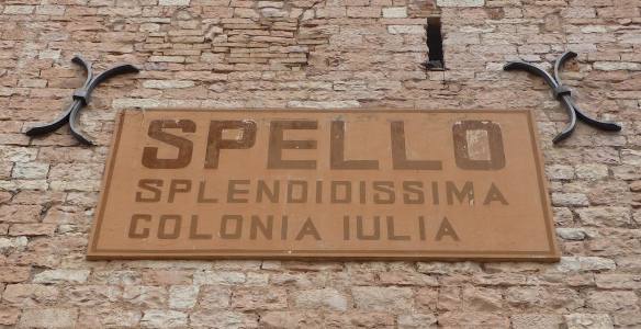
After consulting the map to plan another day trip from Il Castagno, we ventured across the border into Umbria. The warm day was overcast as we reached Spello, an ancient walled town that became a Roman colony, Hispellum, in the 1st century BC.

1.Portonaccio

The town walls and arched entrance gates are remarkably intact, we began our walk at Porta Consolare.

2.Porta Consolare

We were instantly enchanted by this place, with its beautiful architecture

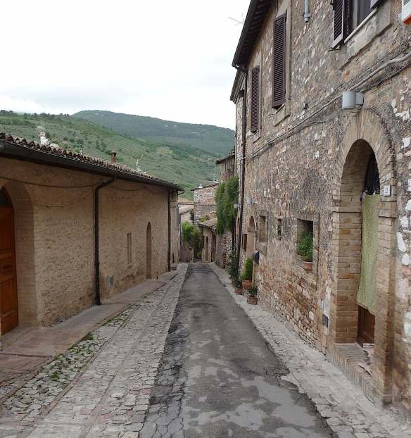
and narrow, stone streets.

12.street

13.street

Magnificent arches led down intriguing alleyways.

We ambled our way to the top of the town, admiring the homes with more than a little envy.

Some windows had better views than others,

and, of course, those fabulous Italian doors were countless.

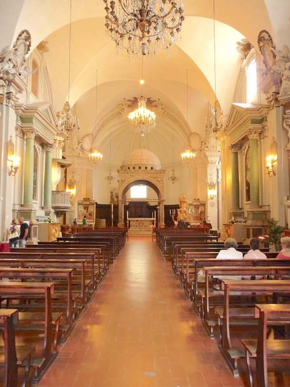
The most impressive doorway was that of the Baglioni Chapel, part of the Church of Santa Maria Maggiore.

44.Baglioni Chapel

The chapel is adorned with well preserved frescoes, painted by Pinturicchio in 1500AD, none of which I photographed.

45.Baglioni Chapel

There was so much to admire in this wonderful, ancient town.

Porta dell’ Arce, a double limestone arc, was the original northern entrance to the Roman city.

We made our way back to the lower end of town, not forgetting to investigate the shops

59.Spello

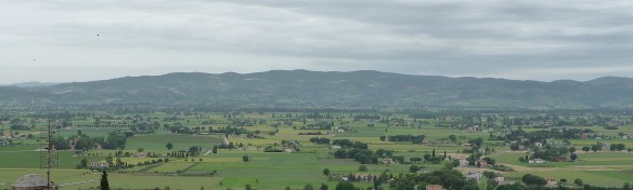
and admire the spectacular scenery along the way.

66.view

Loch Ness

The drive to Inverness took us along the shores of magnificent Loch Ness.

1.Loch Ness

The ruins of Urquhart Castle have prime position on a rocky promontory overlooking the lake. Founded in the 13th century, the castle withstood much conflict during its 500 years as a fortress, eventually blown up in the Jacobite rebellion in 1692.

2.Urquhart Castle3.The Saltire

The scenery was spectacular as we followed the banks of the Loch,

4.Loch Ness

the autumn sunlight creating a diverse palette of hues.

5.Loch Ness6.Loch Ness

The landscape on the opposite side of the road was no less impressive.

7.Loch Ness8.Loch Ness

The largest body of fresh water in Britain, Loch Ness is 39km long and over 200 metres deep.

9.Loch Ness10.Loch Ness

We didn’t see the Loch Ness monster but it isn’t hard to imagine something lurking beneath the surface.

11.Loch Ness


Cape Naturaliste

We continued our traversal of Geographe Bay to our destination, Cape Naturaliste lighthouse.

1.lighthouse

The tower was constructed in 1903 from local limestone and was activated the following year.

2.lighthouseOLYMPUS DIGITAL CAMERA

Unfortunately, we weren’t able to tour the lighthouse which is now fully automated, being the last lighthouse in Western Australia to lose its keeper in 1996.

4.lighthouse

At the northernmost point in the Margaret River Region, positioned on a 100m high bluff, the views were spectacular.

5.stormclouds

Stormclouds were gathering out to sea.

OLYMPUS DIGITAL CAMERA

It is little wonder the French navigator, Nicolas Baudin, named Geographe Bay after his flagship and the cape after his second ship, Naturaliste.

OLYMPUS DIGITAL CAMERA

The traditional owners of the land, the Wardandi, call it Kwirreejeenungup:

8.sign

“the place with the beautiful view”.

OLYMPUS DIGITAL CAMERA

Ossaia

After a lazy afternoon at Il Castagno, we decided to dine in the nearby town of Ossaia. Rather than driving, we walked the easy 2km on a perfect spring evening.

1.road to Ossaia

The countryside was peaceful, scattered with gorgeous rustic farmhouses.

2.chapel3.farmhouse4.farmhouse5.farmhouse

Ossaia literally means boneyard. There are apparently thousands of Roman soldiers who were defeated by Hannibal in 217BC at the Battle of Trasimeno, buried under the town.

The small community was enchanting, with some beautiful homes.

8.town9.town

I’m not sure about this driveway, though.

10.town

La Tufa had been recommended to us and we found it easily.

11.La Tufa

We wandered through

to the inviting restaurant

14.La Tufa

but on this warm night we opted for a table outside.

15.La Tufa

The pizzas were delicious

and we had just enough room for nonna tart and flaming crème brulee.

19.flaming creme brulee

The walk home was a little slower.

Isle of Skye

We hadn’t planned ahead for our trip through Scotland, preferring to see where each day ended. Late October is not the height of the tourist season, however, arriving on the Isle of Skye we found accommodation scarce. We were very fortunate to find a room at Uig Hotel, a beautiful old coaching inn dating back to 1831.

1.Uig Hotel

We settled in at the bar to enjoy some local beverages. A Red Cuillin ale for Michael, brewed locally since 1995 and a Talisker single malt for me from the only distillery on the Isle of Skye. We absorbed the stunning view of Uig Bay and Loch Snizort.

2.Uig Bay3.Loch Snizort

The tower in our sights was a 19th century folly, known as Fraser’s Folly. The tenants of Kilmuir Estate, owned by Major William Fraser in 1855, would go to the folly to pay their rents. The tower was later turned into a family home and eventually abandoned in the 1950s.

4.Fraser's Folly

We enjoyed a superb meal in The Folly restaurant at the hotel, Michael honouring his Scottish roots with a main course of venison haggis. The next morning, we awoke to severe stormy weather. We had decided to explore the island in an anticlockwise direction and see where the road led, we weren’t going to let the elements stop us. The camera stayed safely tucked away until we came across Sligachan Bridge.

5.Sligachan Bridge

Built in the 1820s, it was taking quite a beating from the waters whipped up by the gale force winds.

6.upstream

Apparently, the views of the Black Cuillin mountains are spectacular on a clear day. Legend has it that if you dip your face in the river water by the bridge for seven seconds, you will stay young and beautiful forever. I certainly wasn’t going to try on this day.

7.downstream