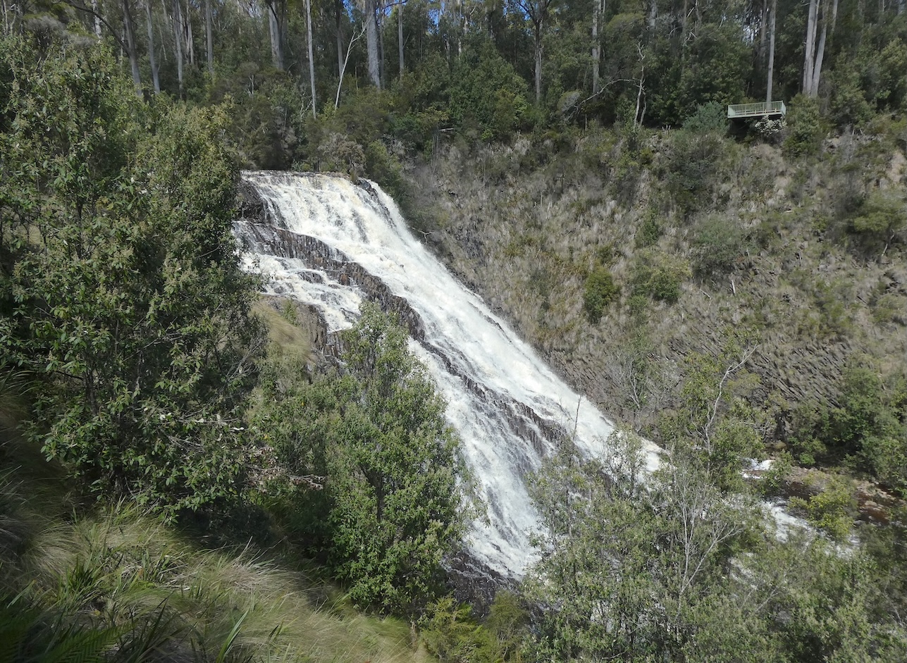
We have been to the town of Stanley on many occasions, it is one of the ‘go to’ places to take visitors. The signpost on the highway to Dip Falls, 27km inland, has always intrigued me but time has been our limiting factor in the past. We decided to stay overnight on our latest trip which gave us the opportunity for a detour and picnic lunch. The peaceful drive through picturesque farmland was on a mostly sealed road with the last few kilometres unsealed but well maintained. We chose to view the falls from below first, the initial impression on our descent held promise of something spectacular.
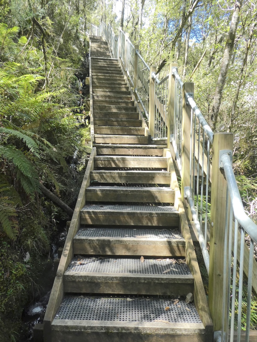
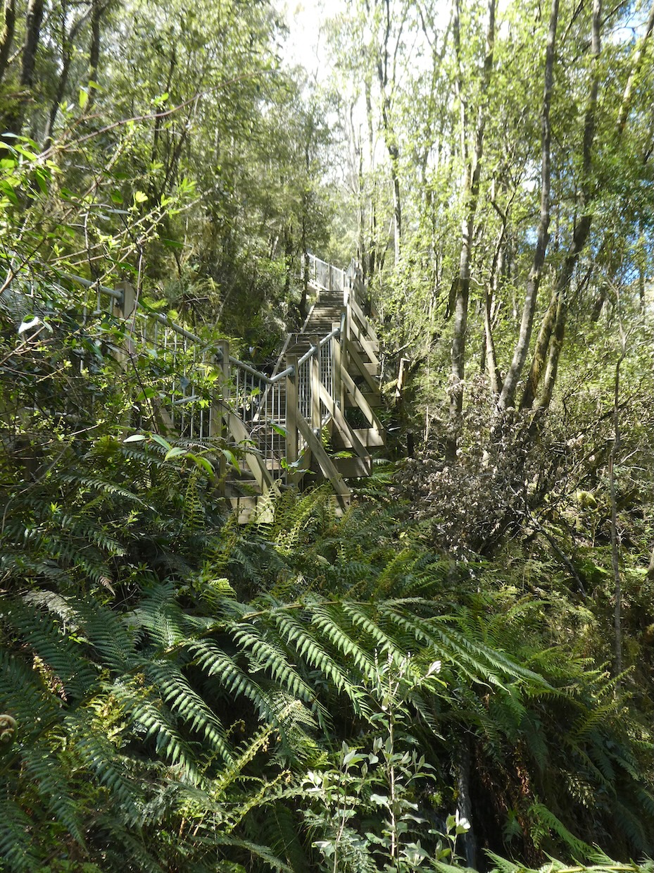
The stairs are steep but easily traversed (with a rest or two on the ascent).
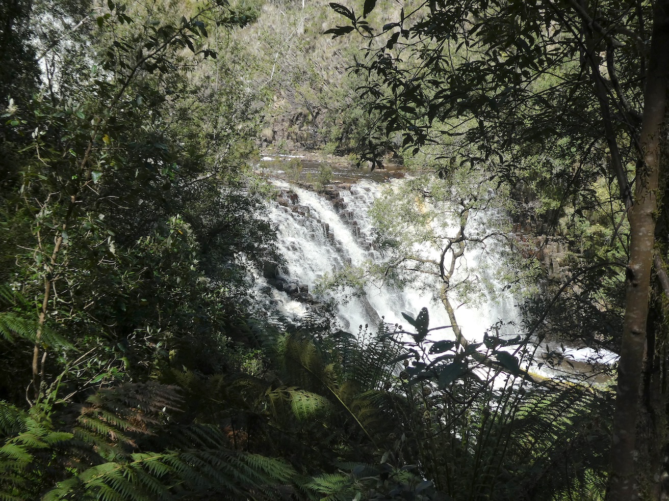
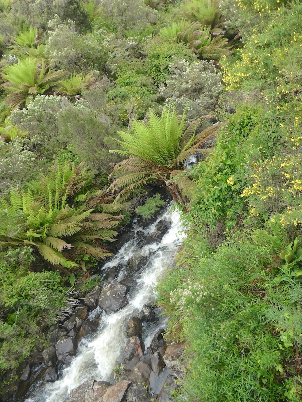
The roar of the tumbling water and further glimpses through the foliage spurred us on.
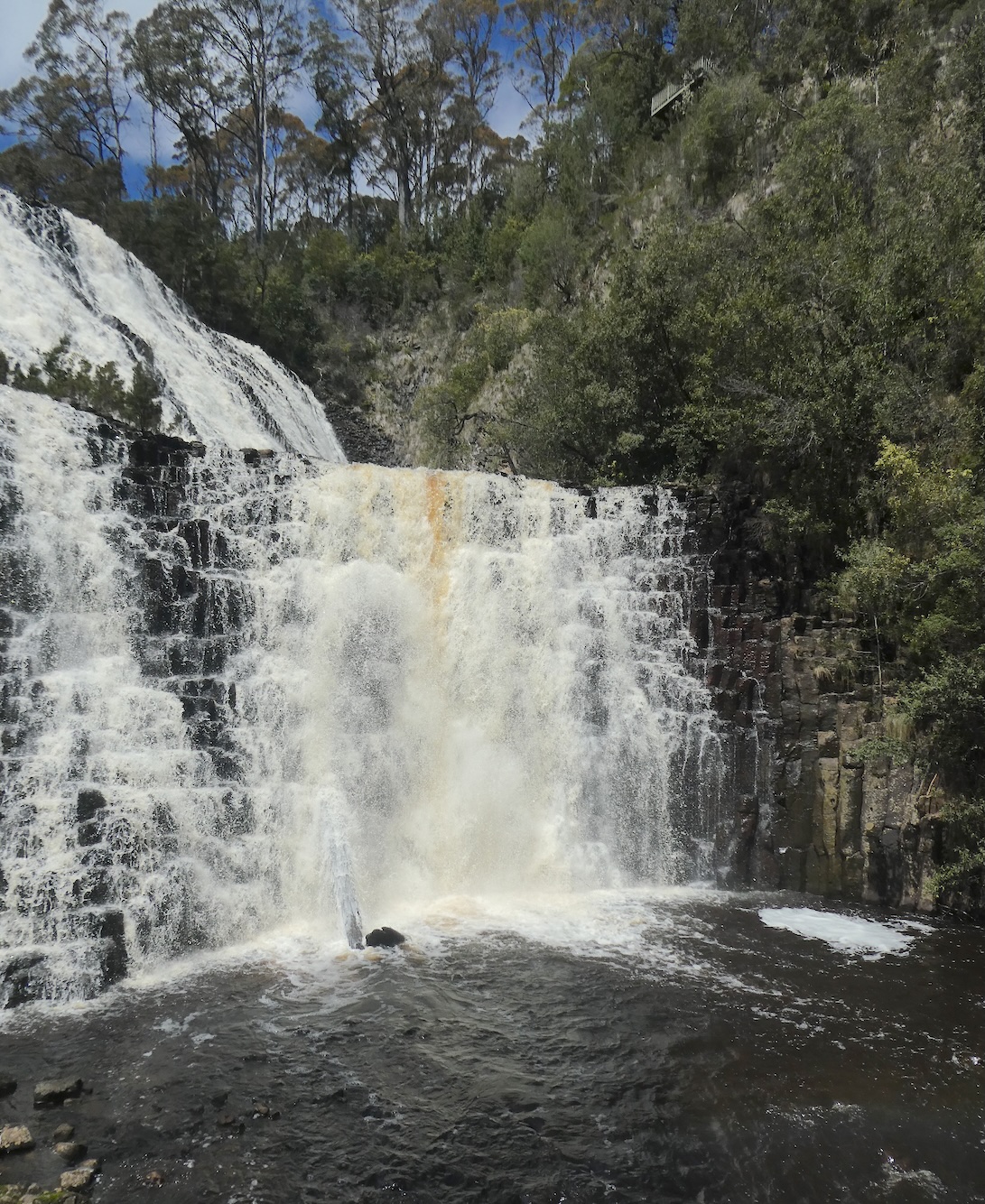
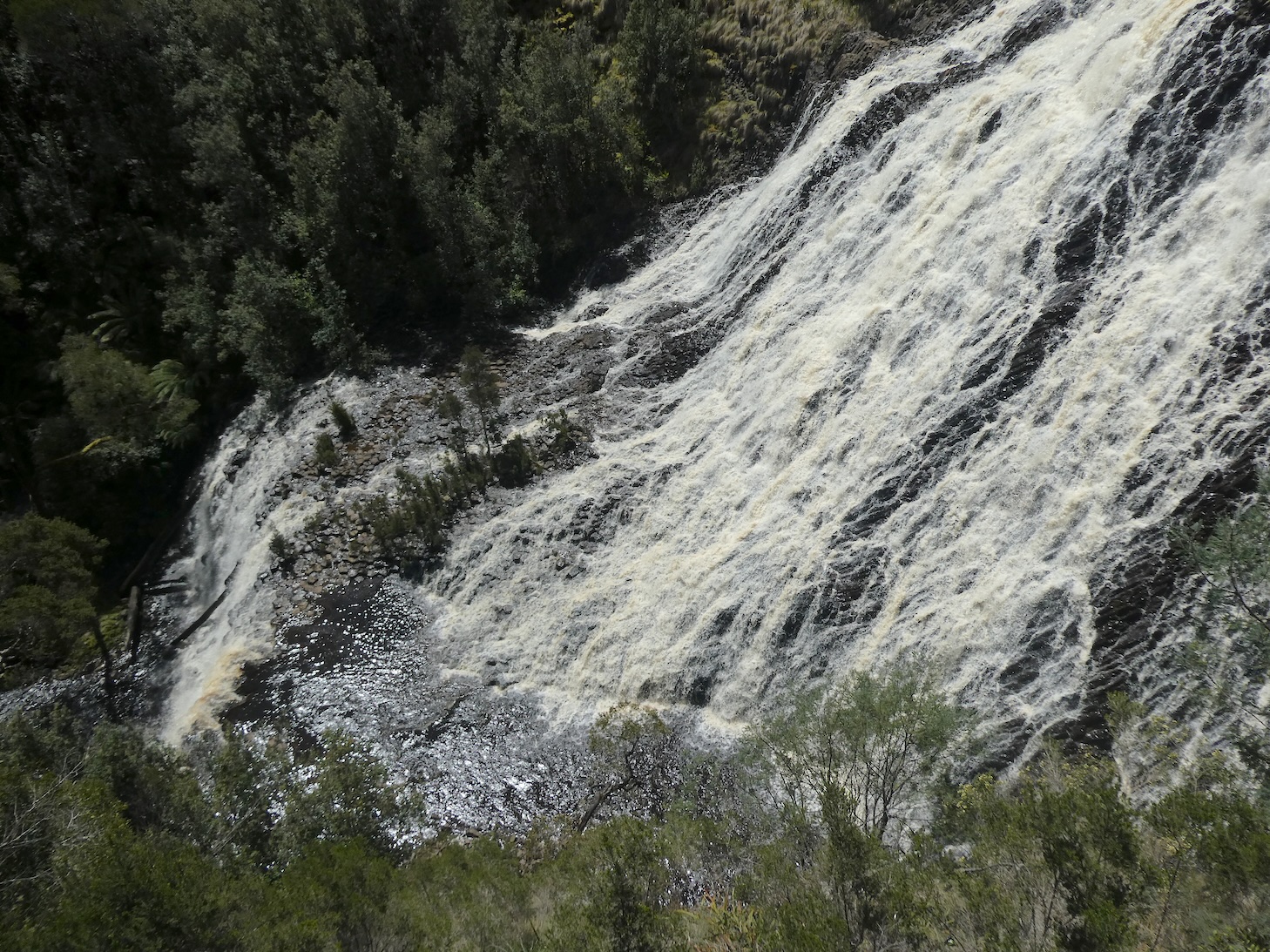
The wonder that awaited us was breathtaking.
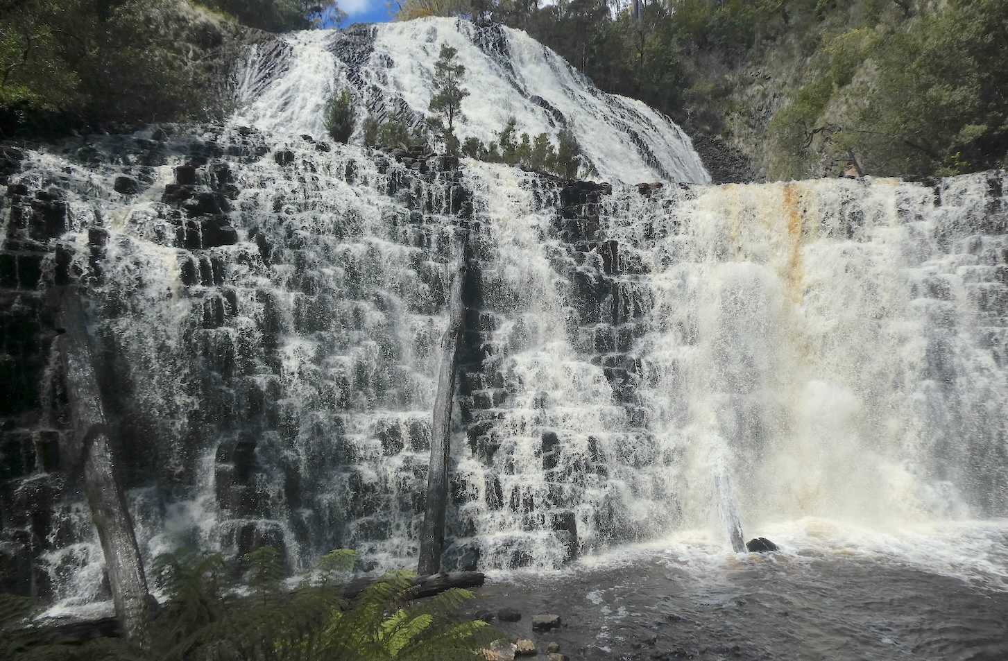
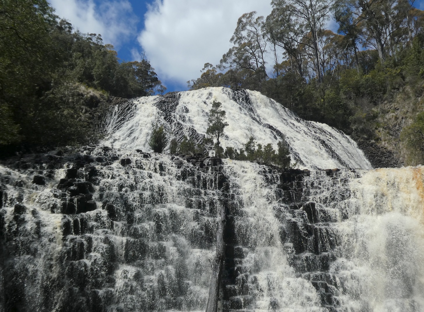
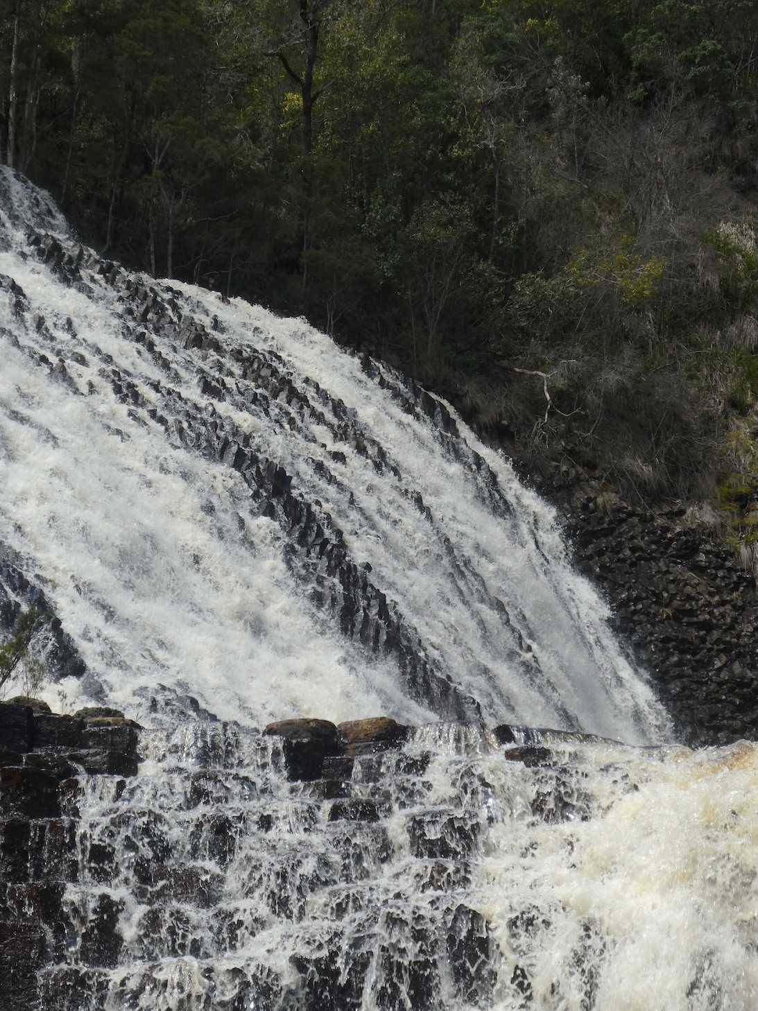
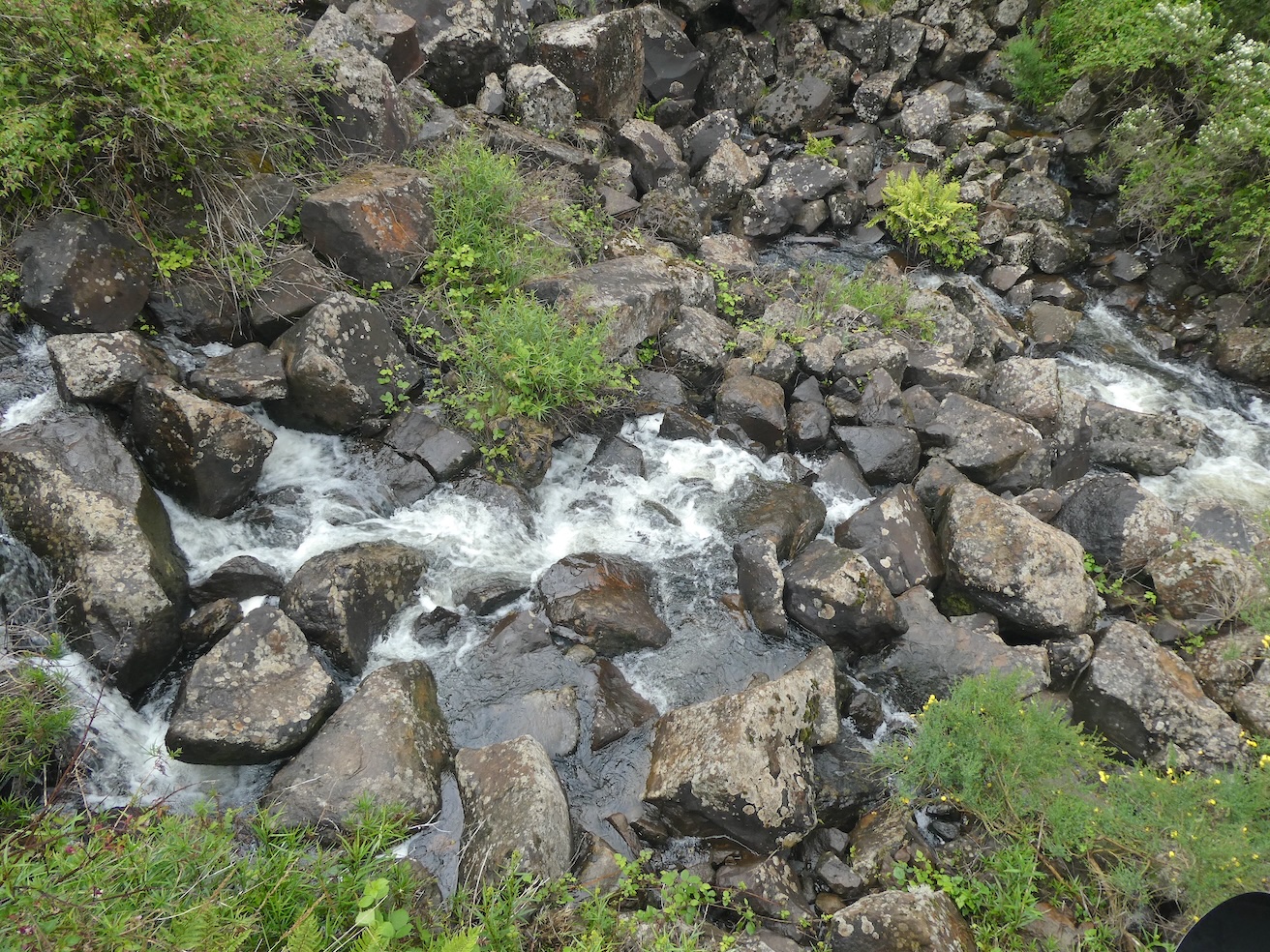
In the absence of a very wide angle lens, I resorted to photographing sections of the falls as the two tiers dropped thirty metres over distinctive dolerite columns.
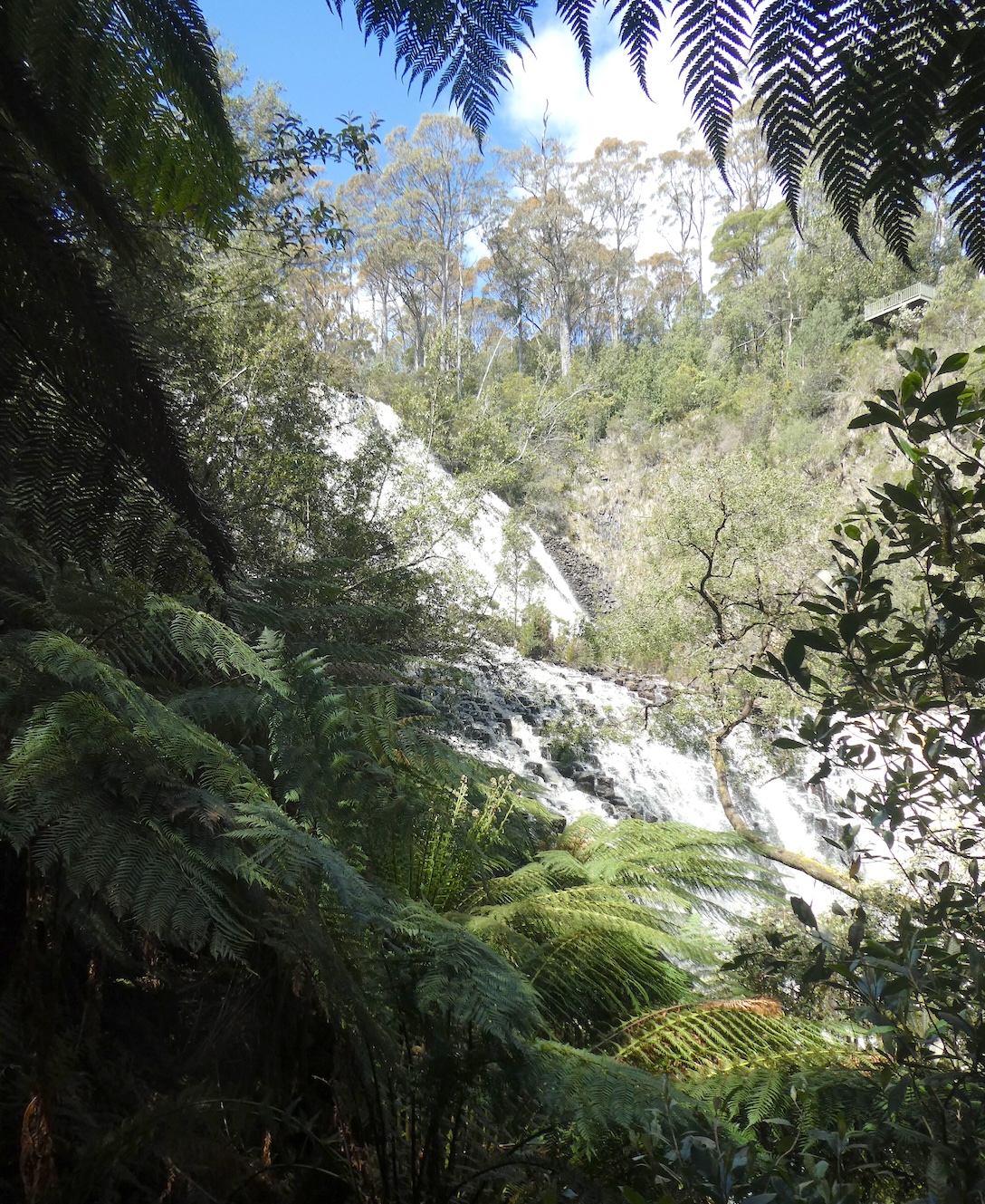
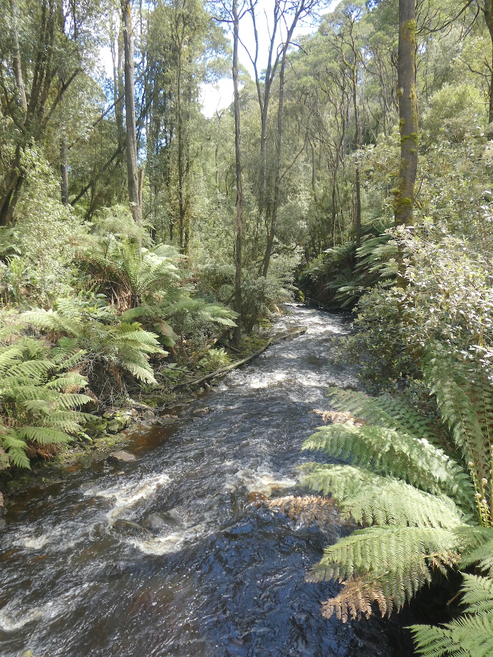
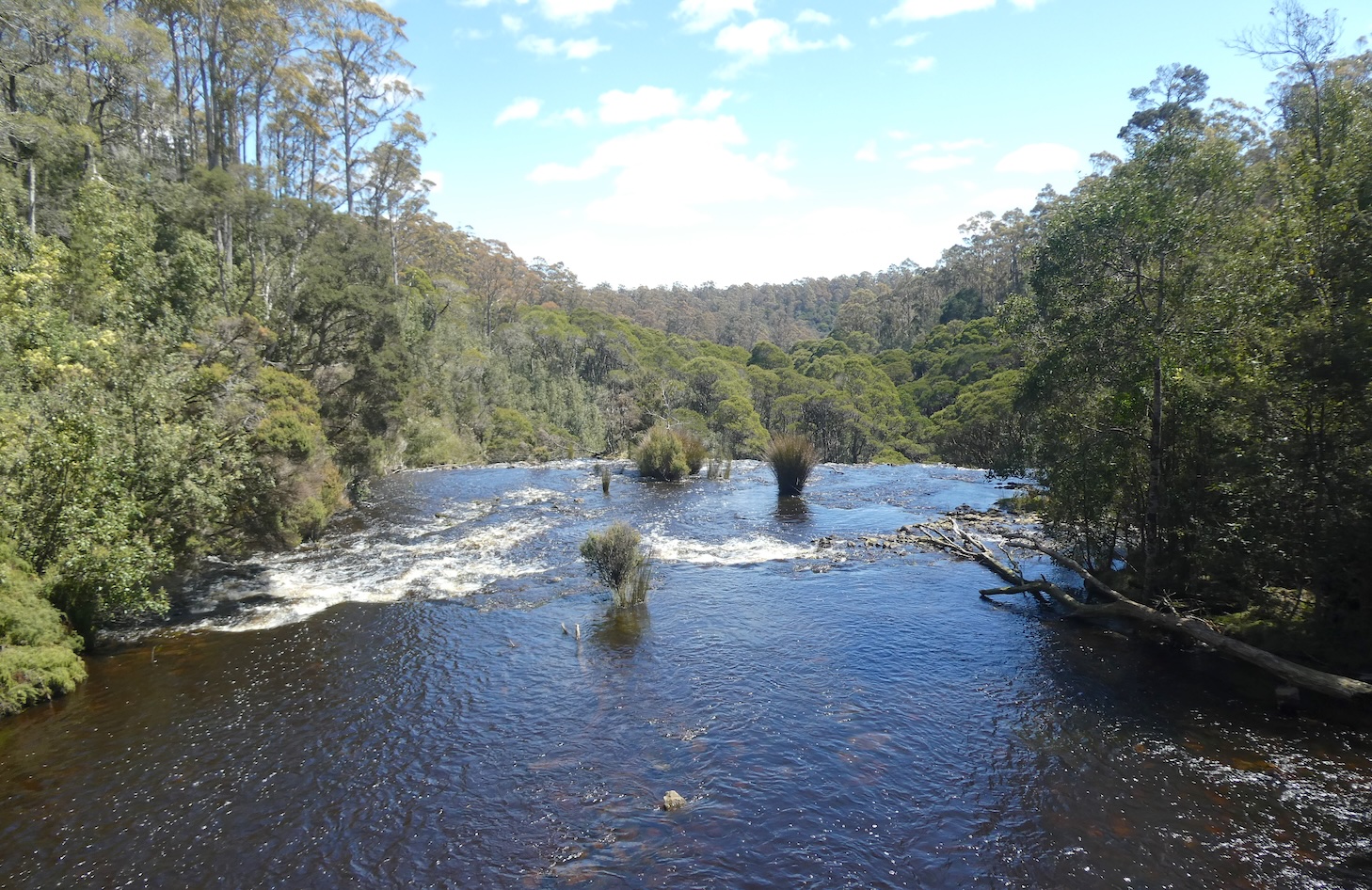
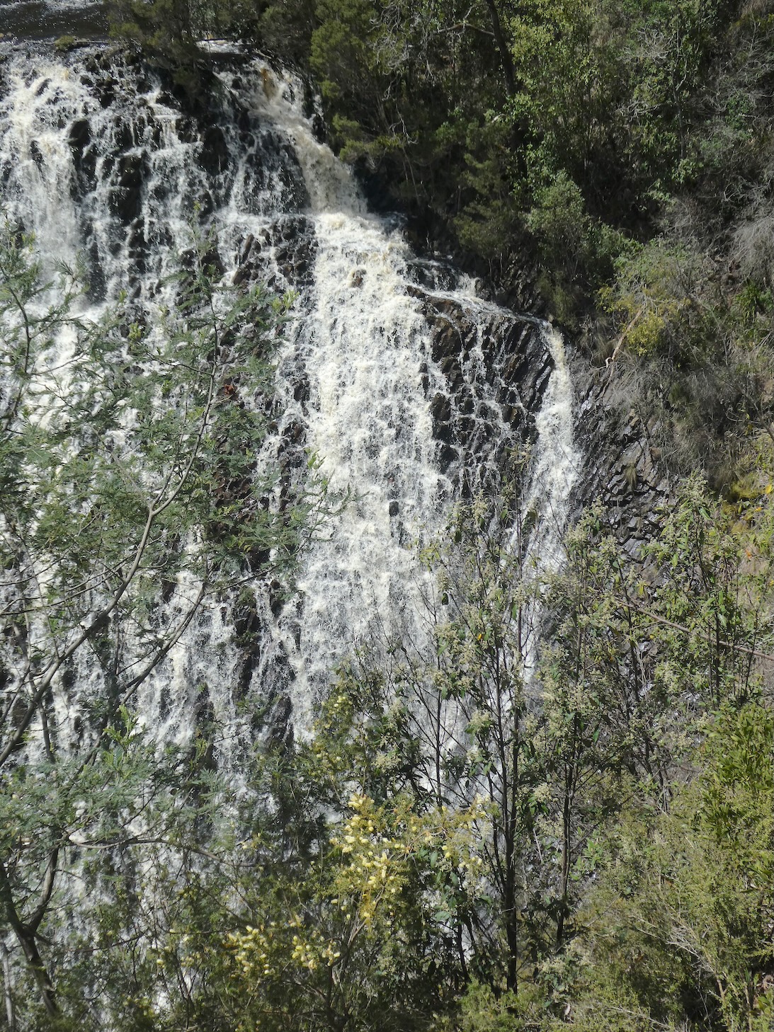
The tranquility downstream belied the tempest of the falls mere metres away.
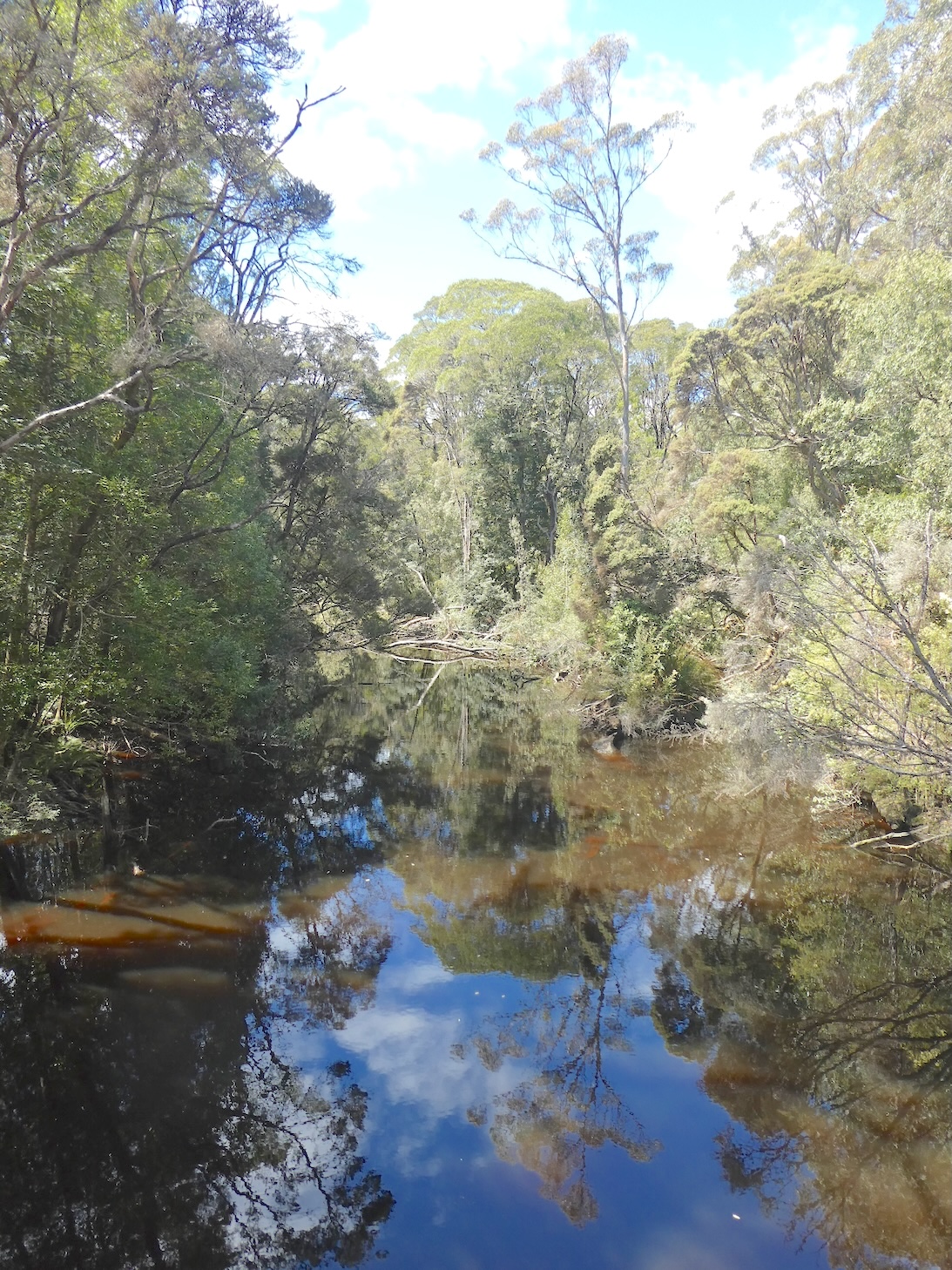
At the top of the falls, the serene waters were idyllically unaware of their impending adventure.
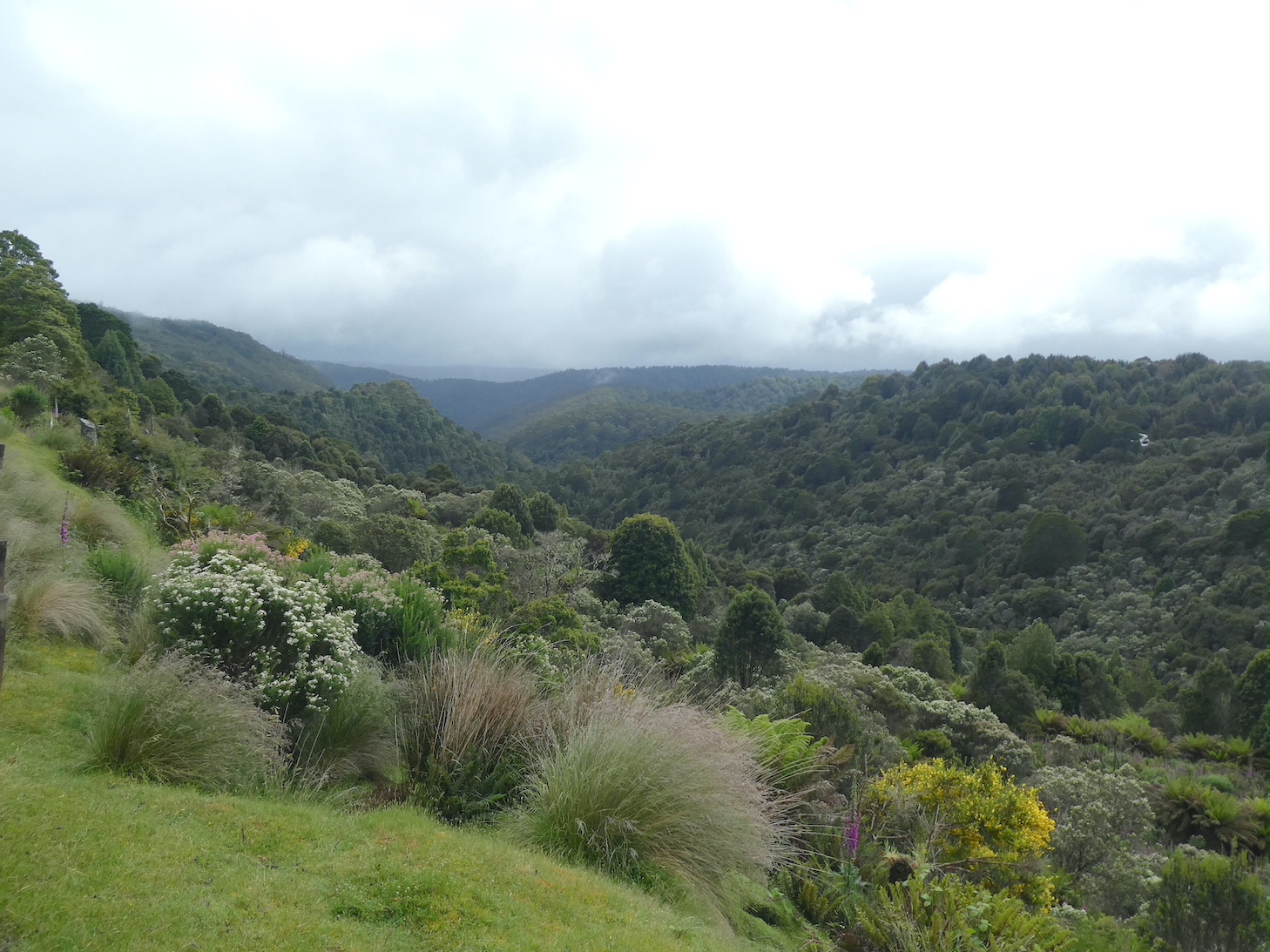
Even from the lookout, the extent of the vista demanded serial photographs.
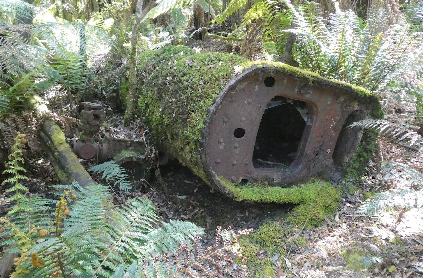
Dip River was once a working forest and during the 1920s, the small community of three houses endured isolation and hardship to manage the sawmill. Not far from the top of the falls, remnants of an old boiler that provided steam to power the sawmill, lies as a reminder of Tasmania’s timber heritage.
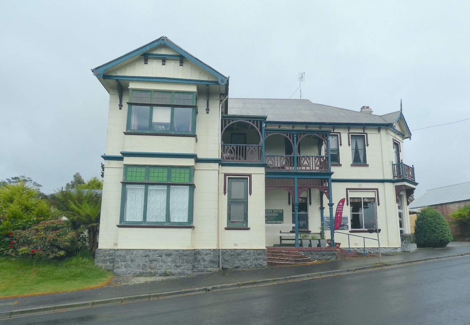
Our journey to Corinna took us through the former mining town of Waratah on the edge of Tasmania’s west coast wilderness. The plan was for lunch at the Bischoff Hotel, the only hotel remaining in the town. Originally built in 1879, it burned down in 1902 before being rebuilt and burning down again in 1909. The present Queen Anne style incarnation was completed later that same year.
The view from the hotel is spectacular, even on a drizzly day
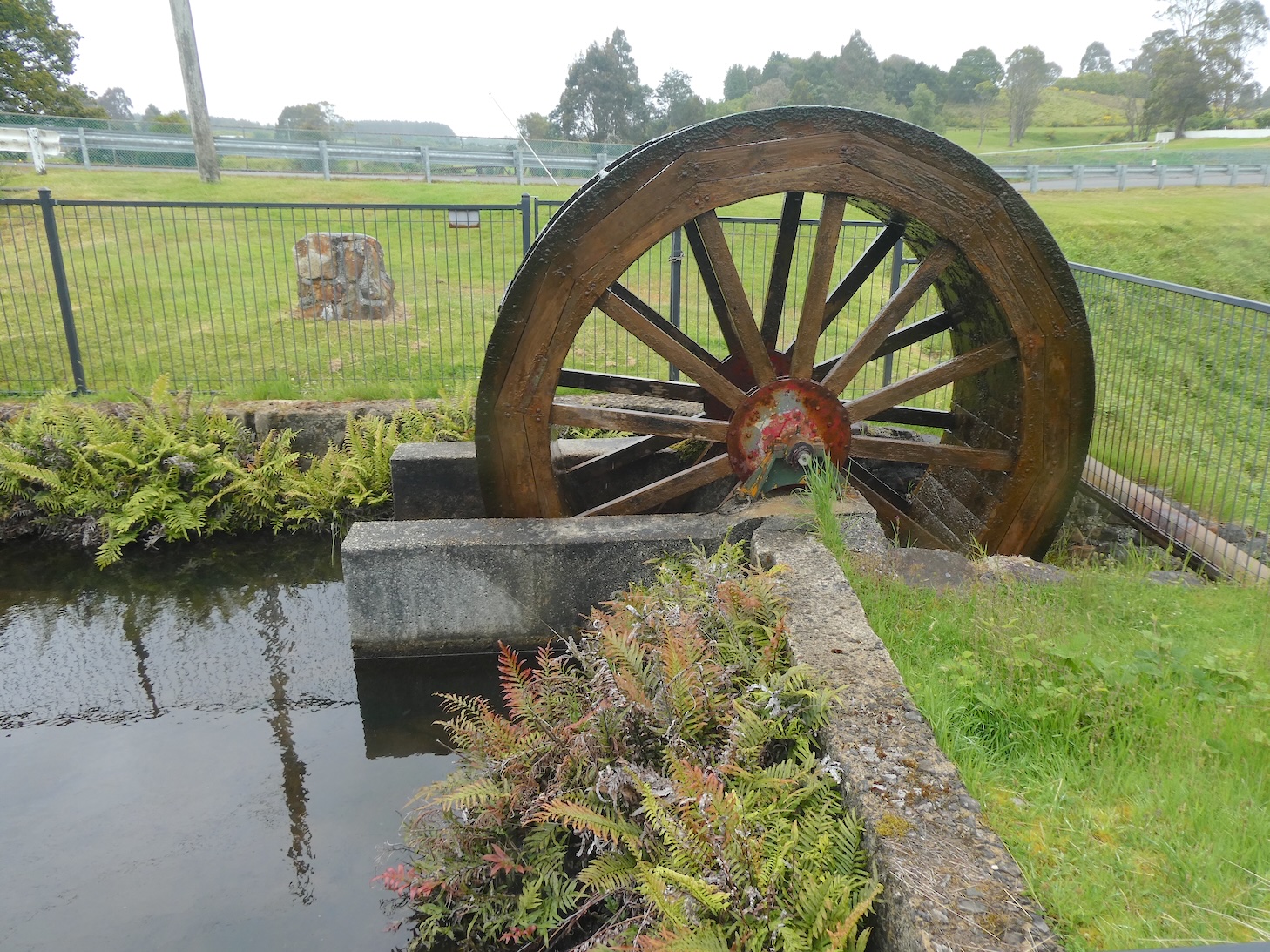
and the waterfall in the middle of town flows all year round. The water provided vital power to the mine directly through a series of seven water wheels and was later piped to the Waratah Power Station to produce hydro power.
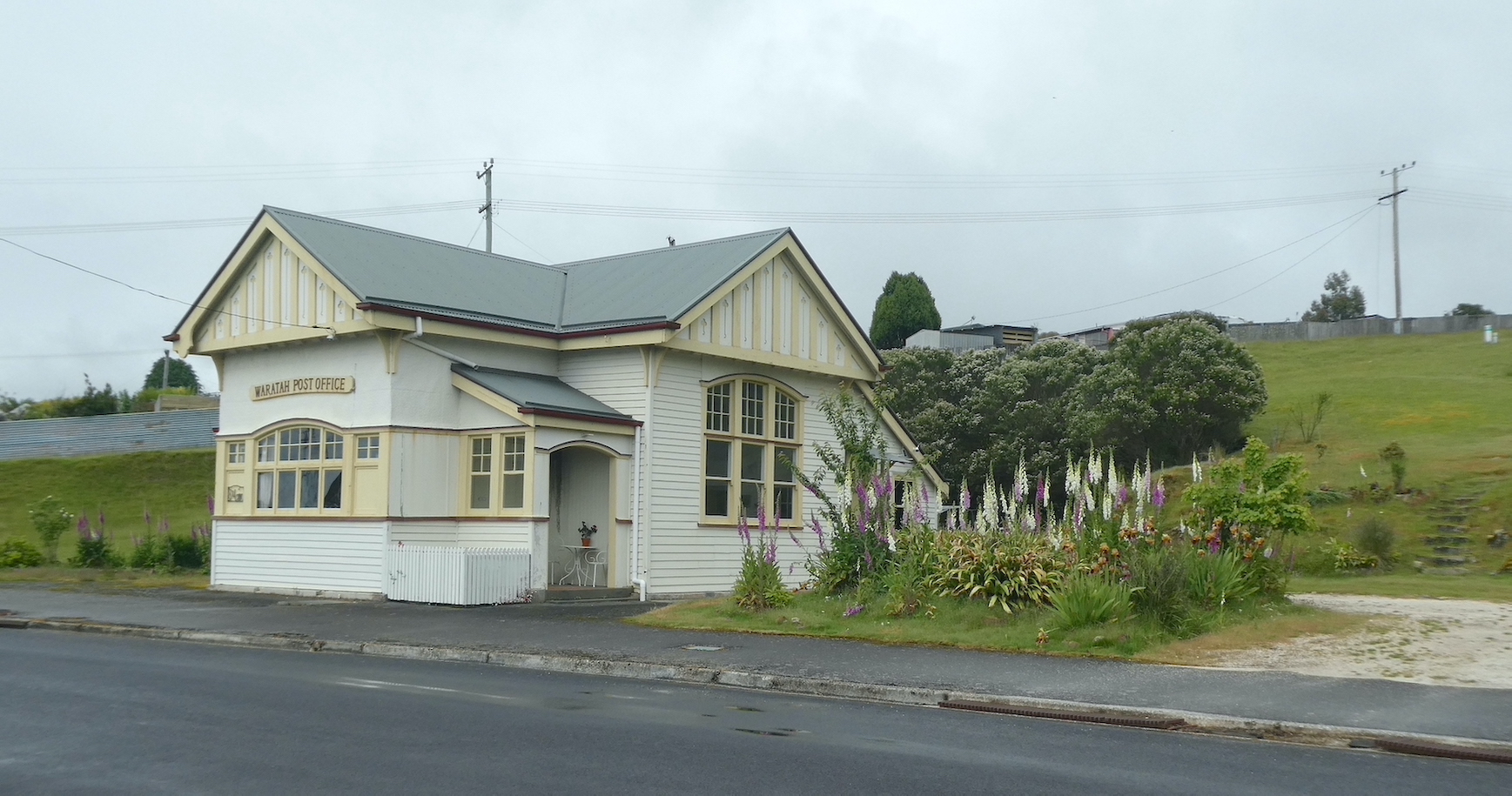
With some time to spare before dining, we set out to explore. The Waratah Post Office opened in 1882 and the current building replaced the original in 1913. It has been lovingly restored and is now available as luxury holiday accommodation.
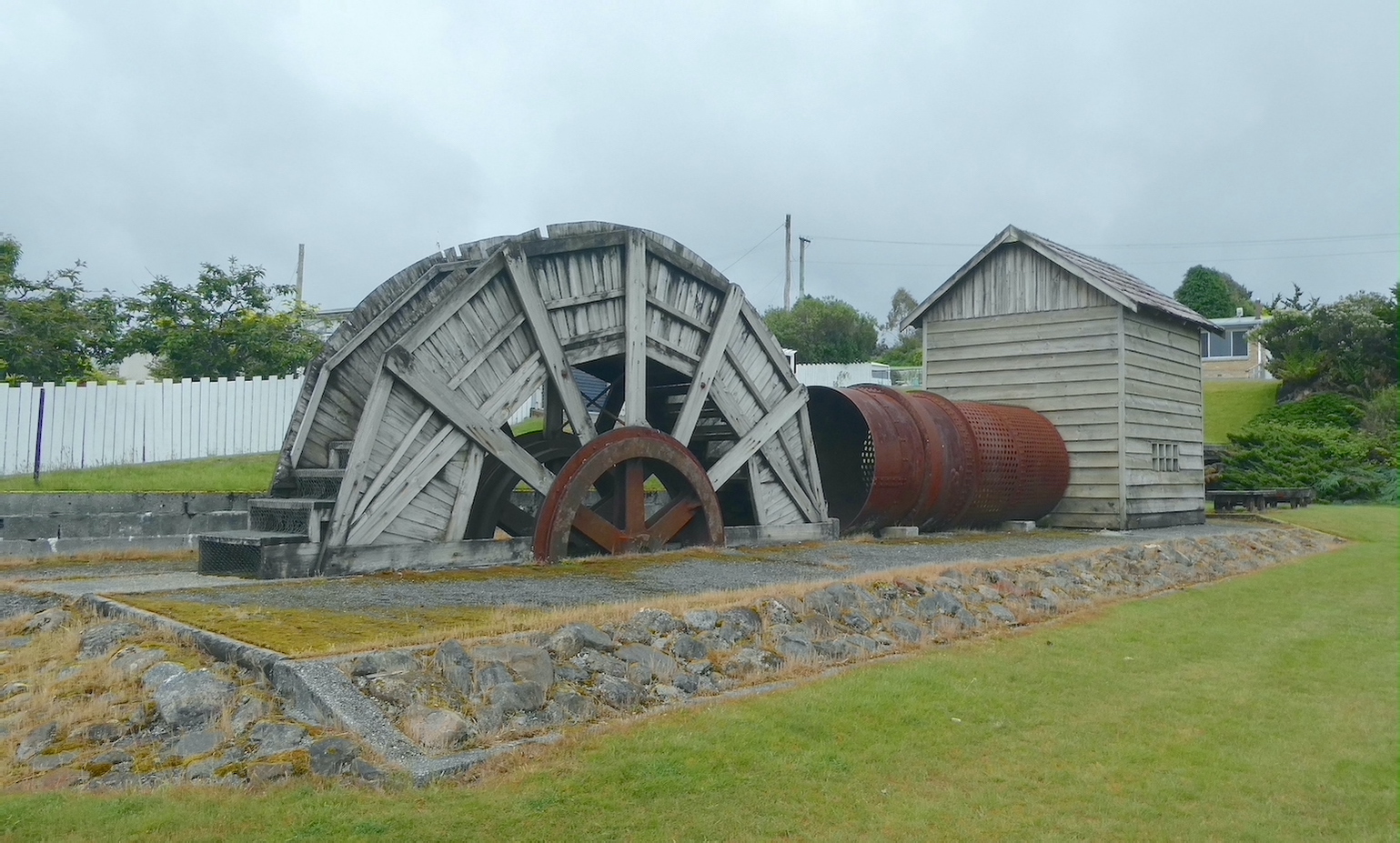
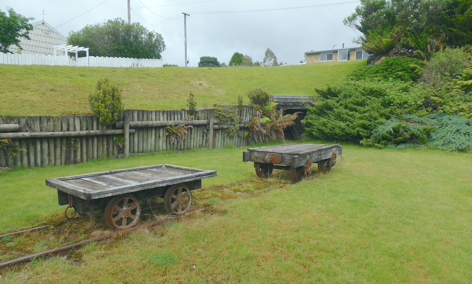
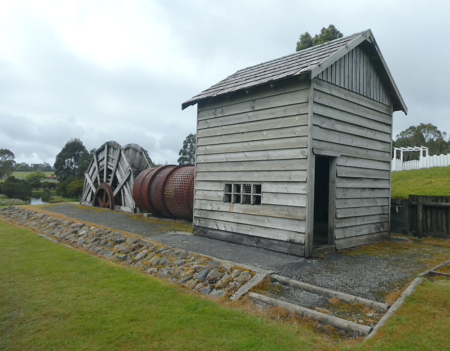
We made our way to the lake and came across an old waterwheel and pump house near what appeared to be an old entrance for the mine carts.
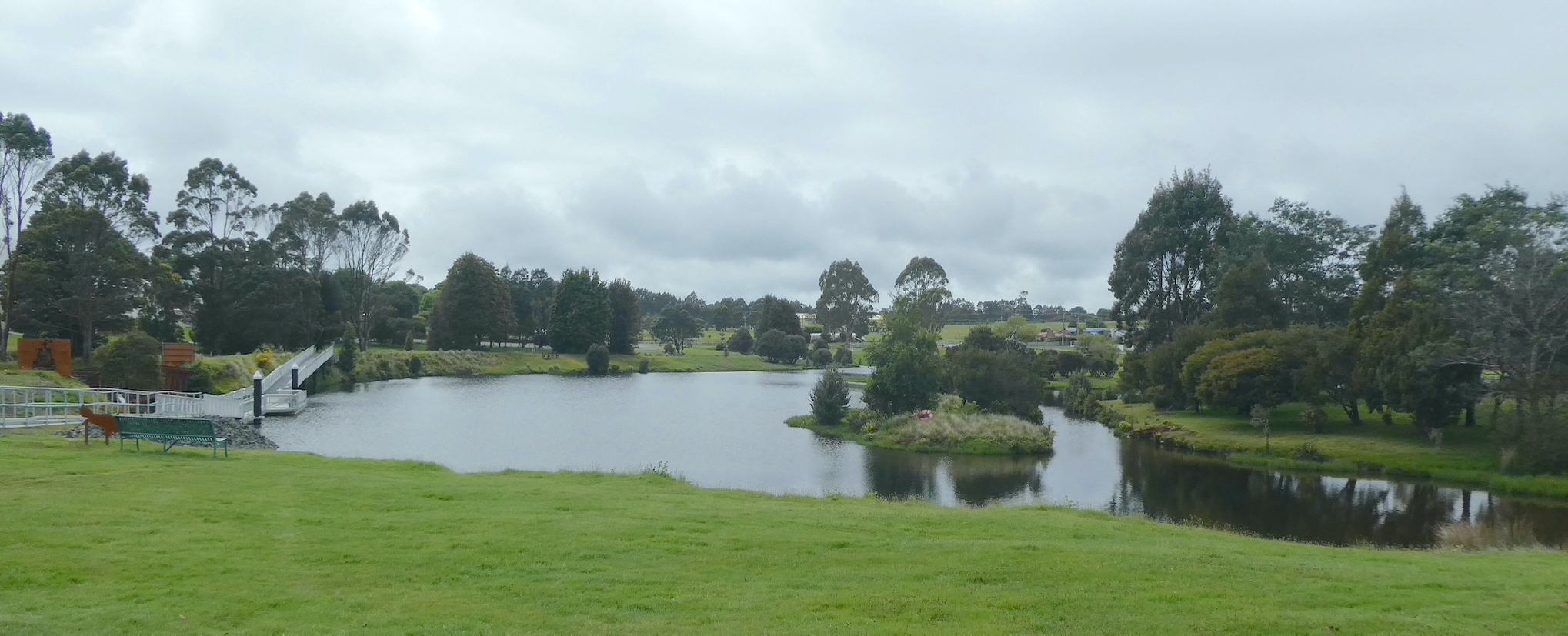
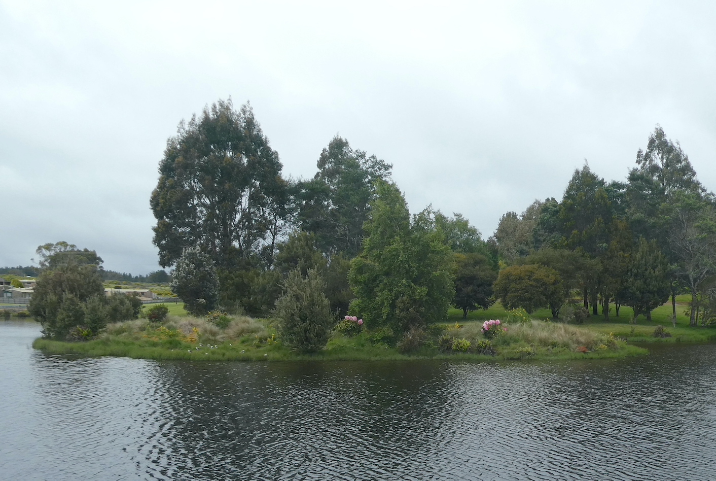
As we entered the town, we noticed how immaculate the public lawns and gardens were kept. Lake Waratah is a beautiful centrepiece.
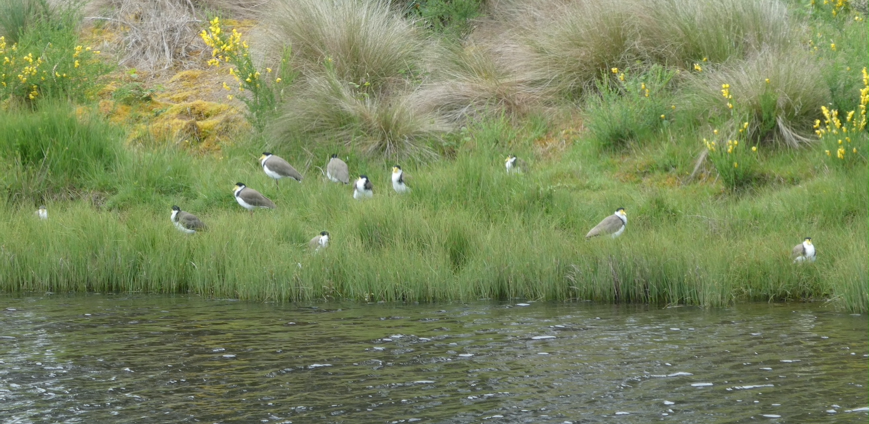
I have never seen a colony of masked lapwings in these numbers, they have chosen a lovely spot to call home.
We took a closer look at the iron truss rail bridge, built over the Waratah River in 1895, essential for getting people and supplies to Waratah and getting the ore out.
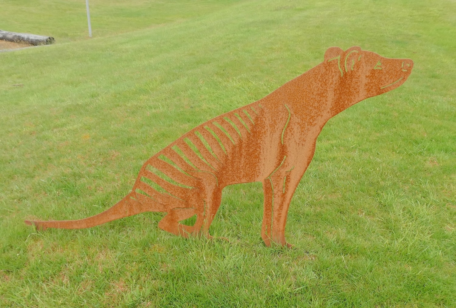
Waratah is known as one of the last bastions of the thylacine, thought by some to be extinct. We are ever hopeful of proving this theory wrong, it seems we are not alone.
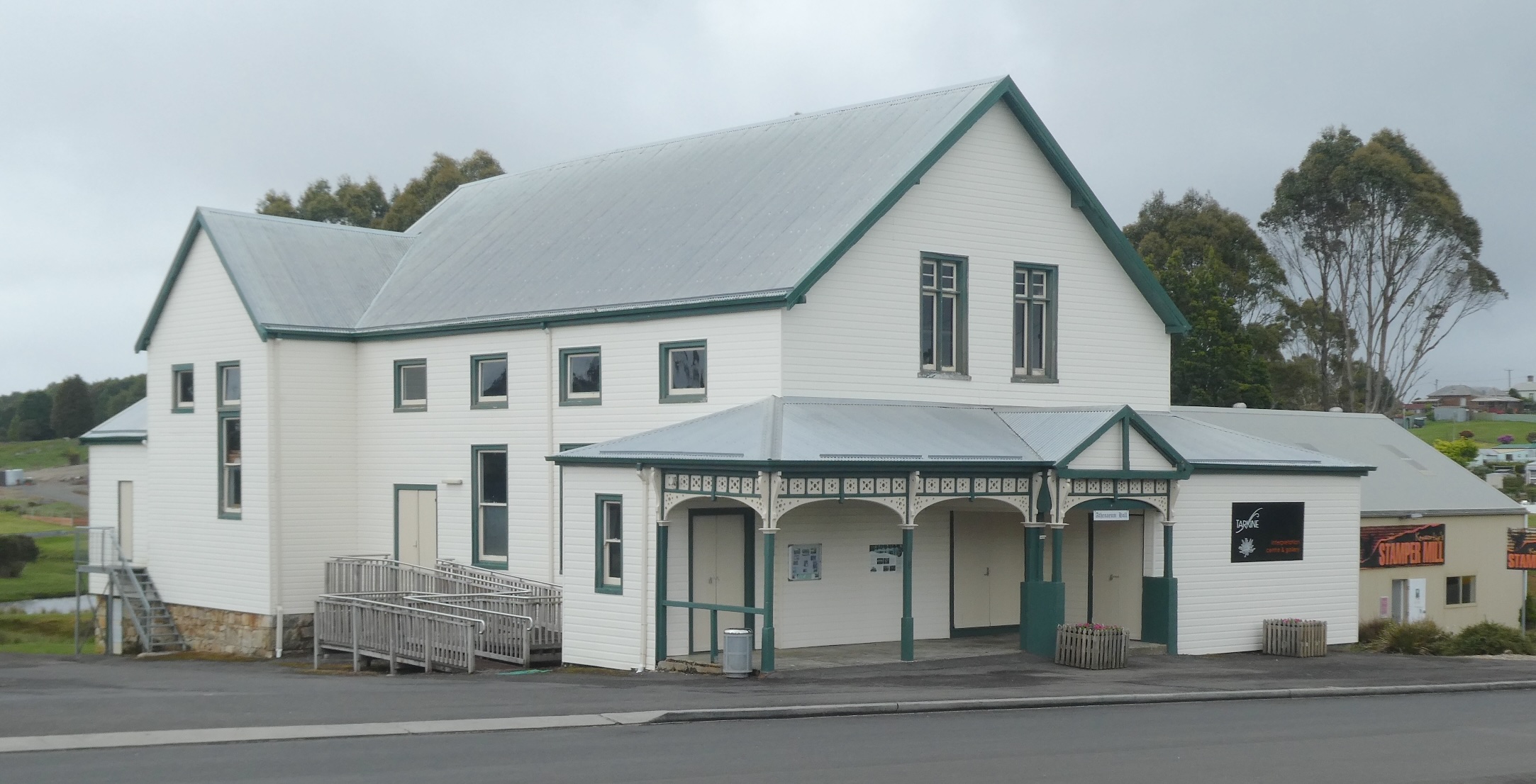
The Athenaeum Hall is a very impressive building completed in 1887 when the town was enjoying the economic prosperity provided by the tin mine. Built for the workers and families, it started as a library and later became the town hall and cinema. Today, it is home to the Tarkine Visitor Interpretation Centre and is still used for functions.
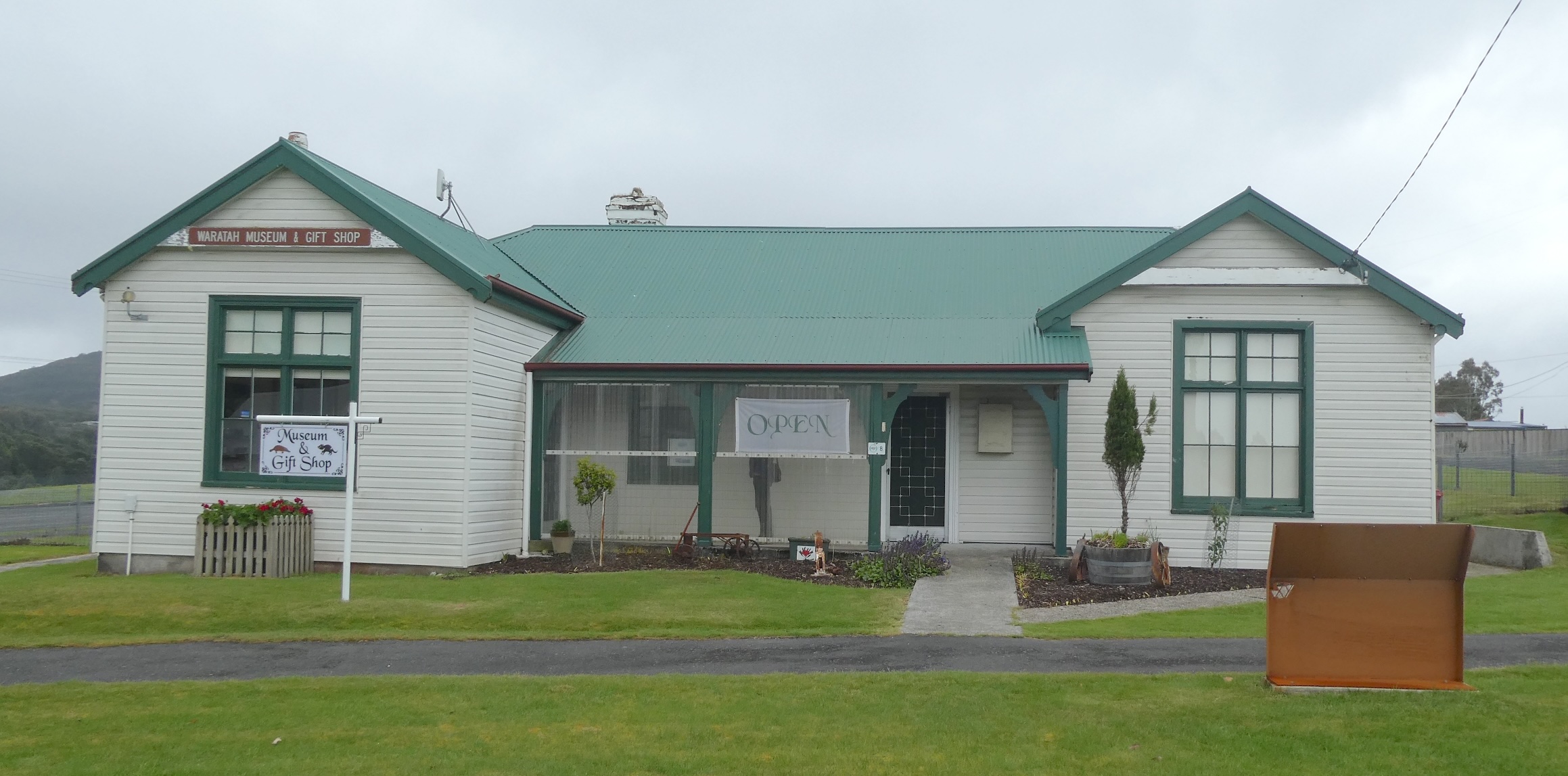
Across the road, the Waratah Museum occupies in the old Court House (that will be another post).
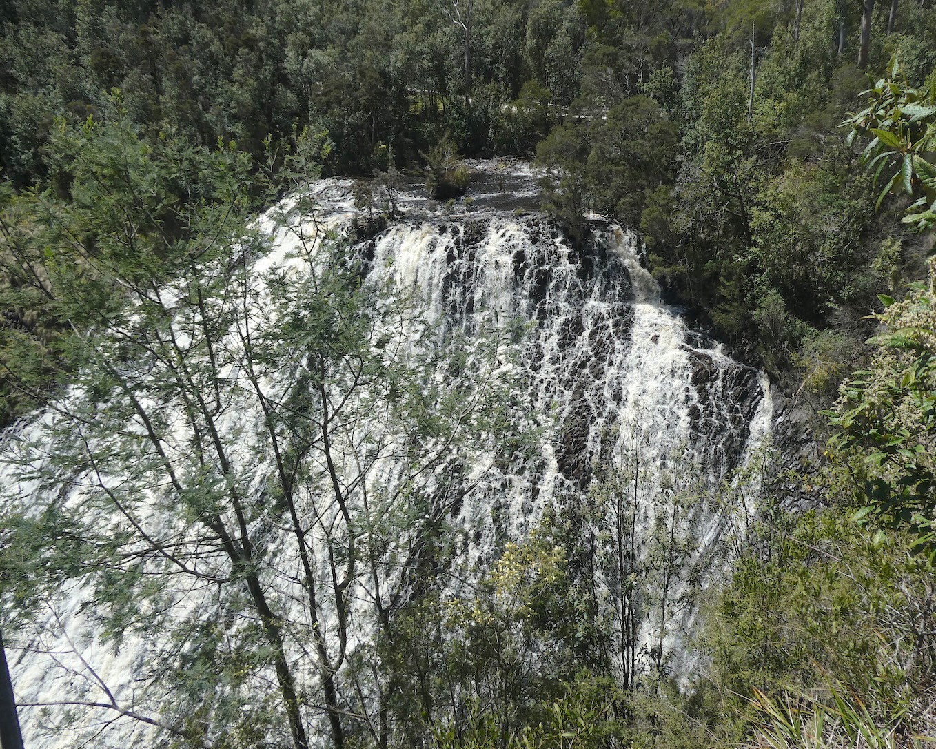
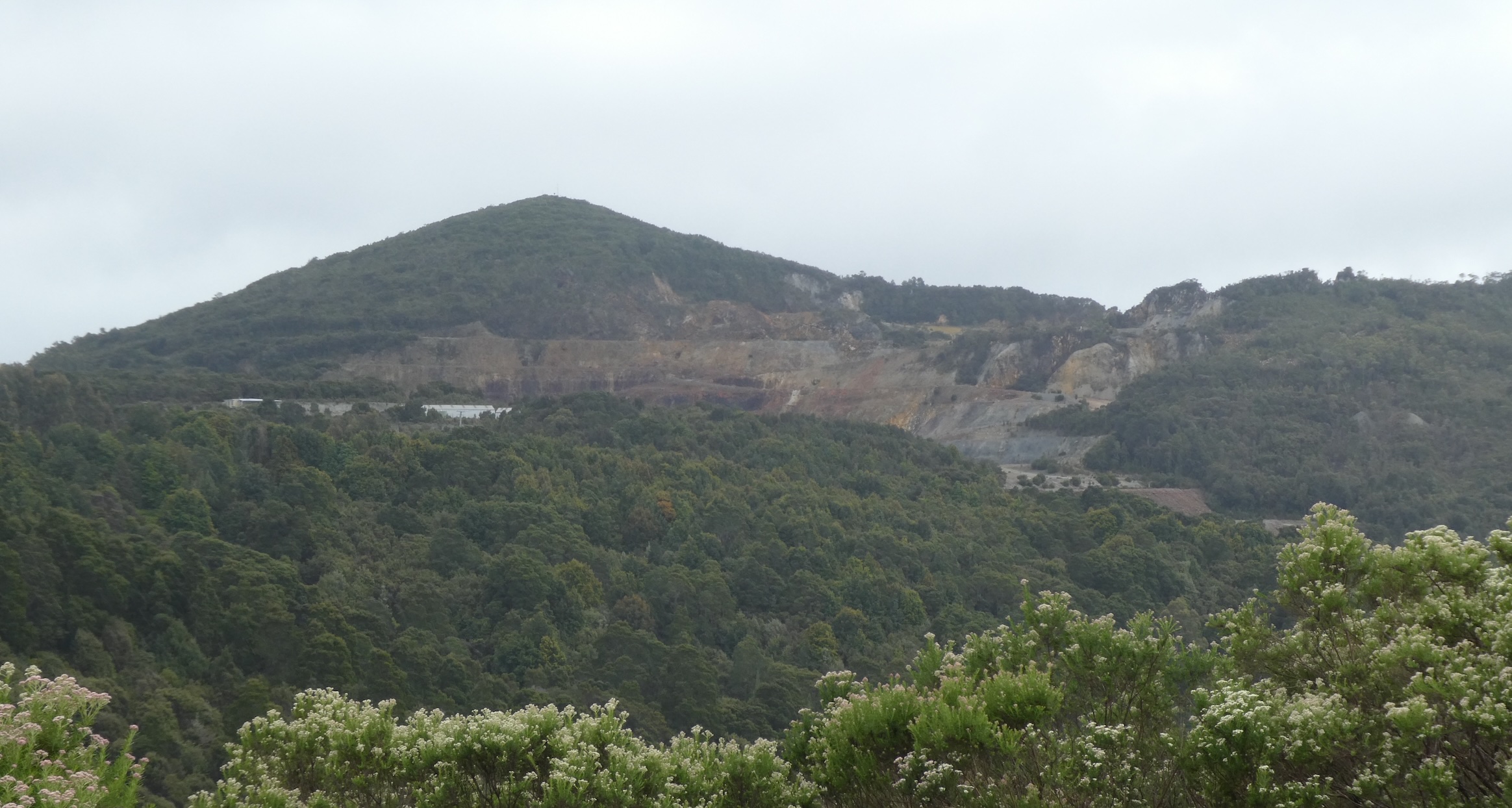
Despite a leisurely perambulation around the museum, we still had time for a walk to the bottom of the falls. The scarred landscape of the Mt. Bischoff mine loomed in the distance. Tin was discovered in the area in 1871 and by 1881, Mt. Bischoff was the richest tin mine in the world. The mine closed in 1947 after seventy years of continuous production but open cut mining resumed in 2008. Three years later, with resources depleted, it again closed and the pit is now flooded.
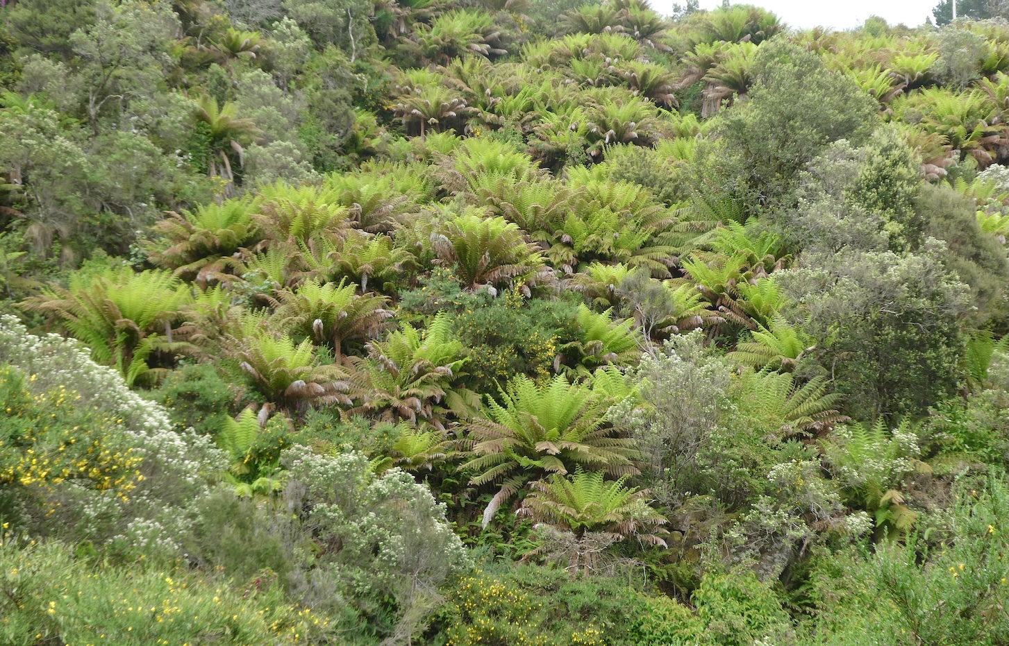
The walking trail was enveloped by tree ferns and verdant native vegetation
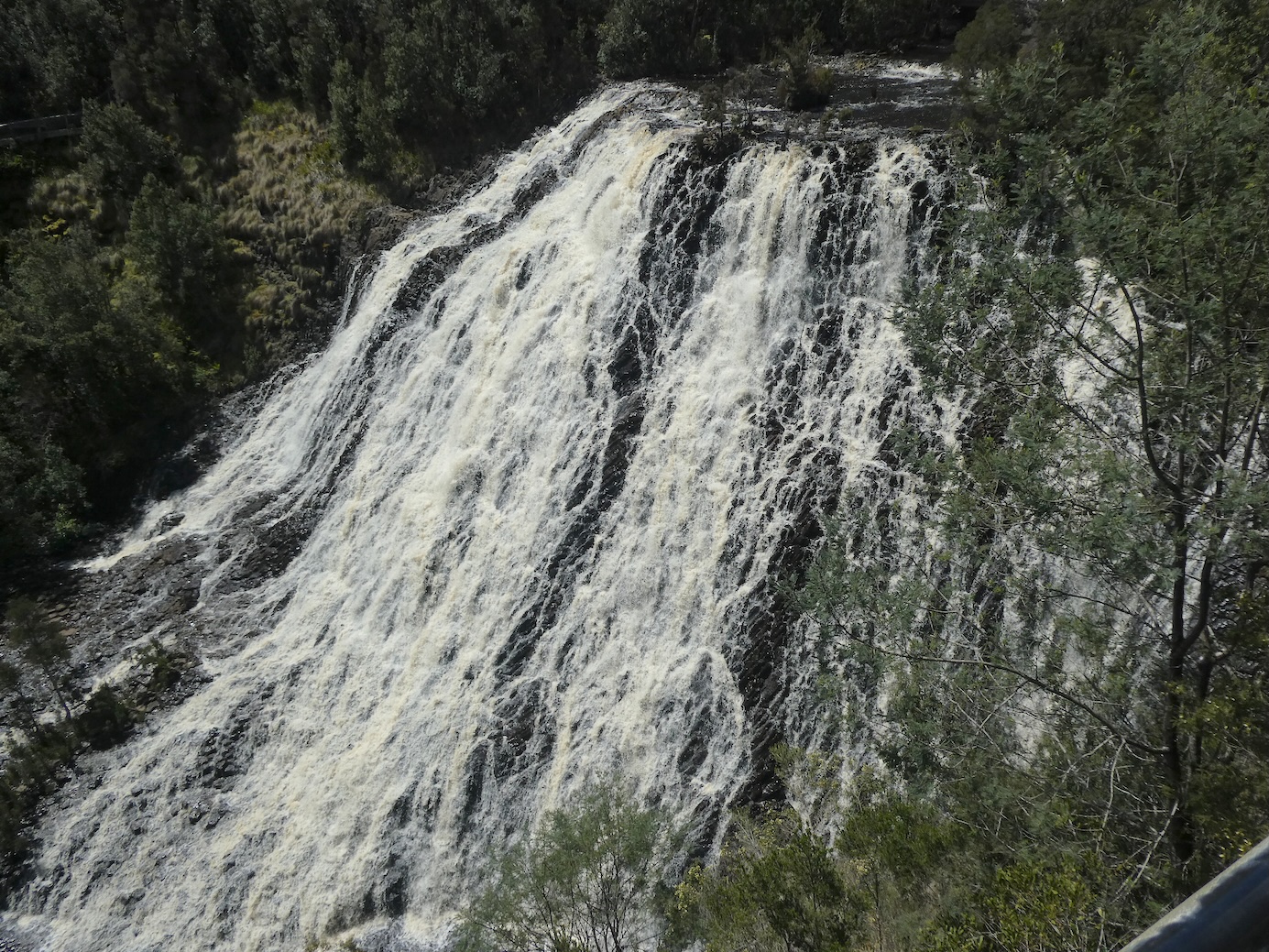
and the waterfall was magnificent after steady spring rain.
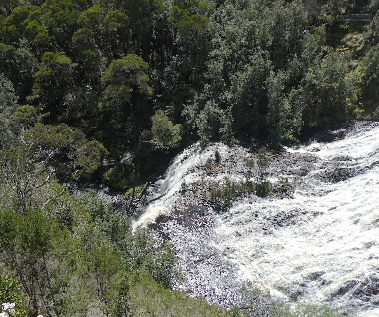
Returning to the top of the falls, the Waratah River wends its way over the cliff and continues ten kilometres before merging with the Arthur River.
The Dudley Kenworthy water wheel is named after the gentleman who recognised the potential to harness the year round water supply, making Waratah the first industrial site in Australia to be lit by hydro-electricity.
After a substantial lunch of delicious fish ’n’ chips and a schooner of stout, we were ready to tackle the long and winding road to Corinna.
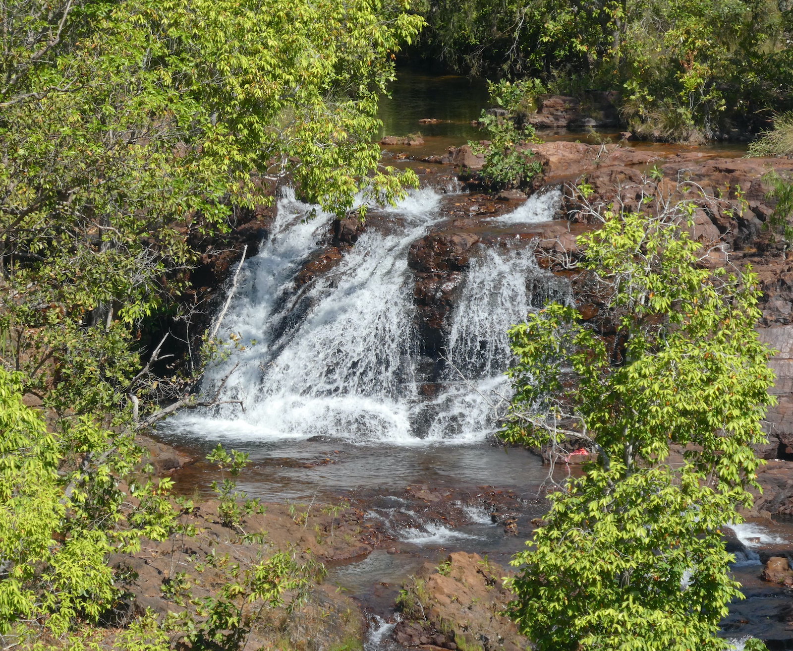
We had worked up an appetite with our morning explorations of Litchfield Park and found a secluded spot for a picnic lunch alongside Florence Creek.
The spring fed watercourse bubbles along, tumbling over a series of cascades until it reaches the escarpment at Florence Falls.
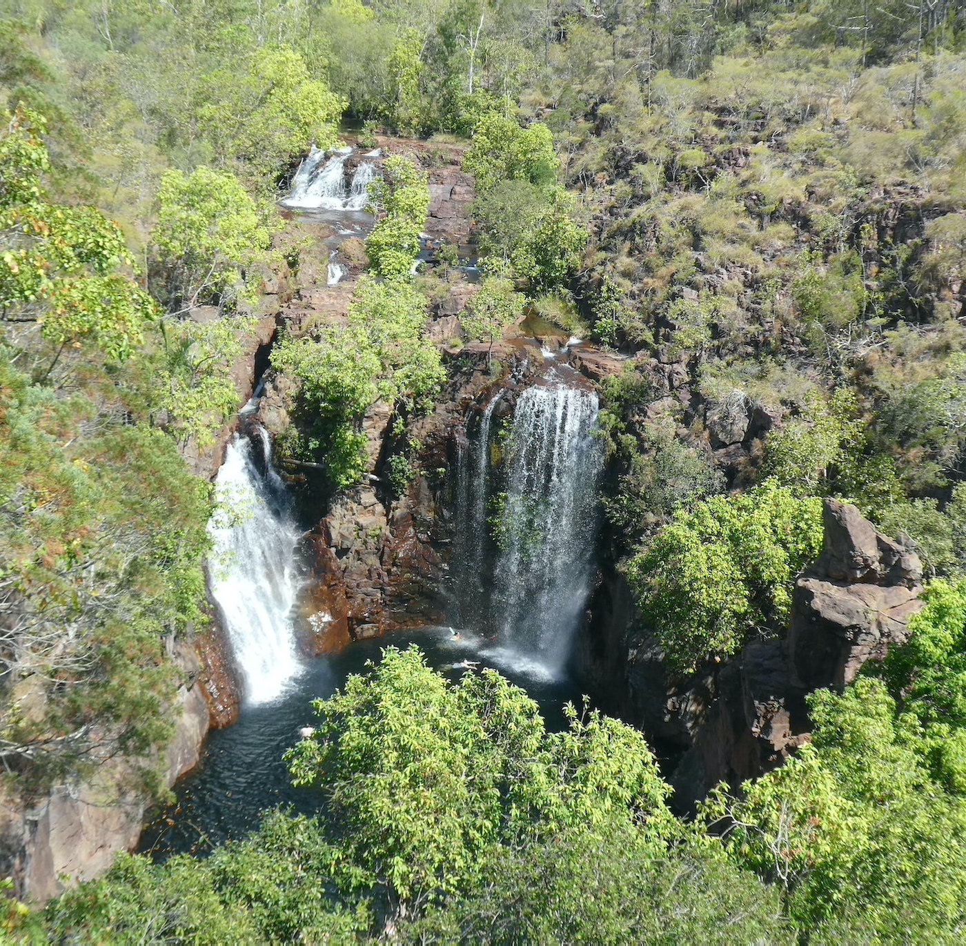
A stunning panorama from the viewing platform takes in the lush monsoon forest surrounding the falls.
The multi-tiered falls drop around 40 metres in total while the main cascade is around 20 metres.
There are 160 steps to the swimming hole at the base of the falls. Tempting though it was to cool off in the pristine water, the return climb would have been a step too far.
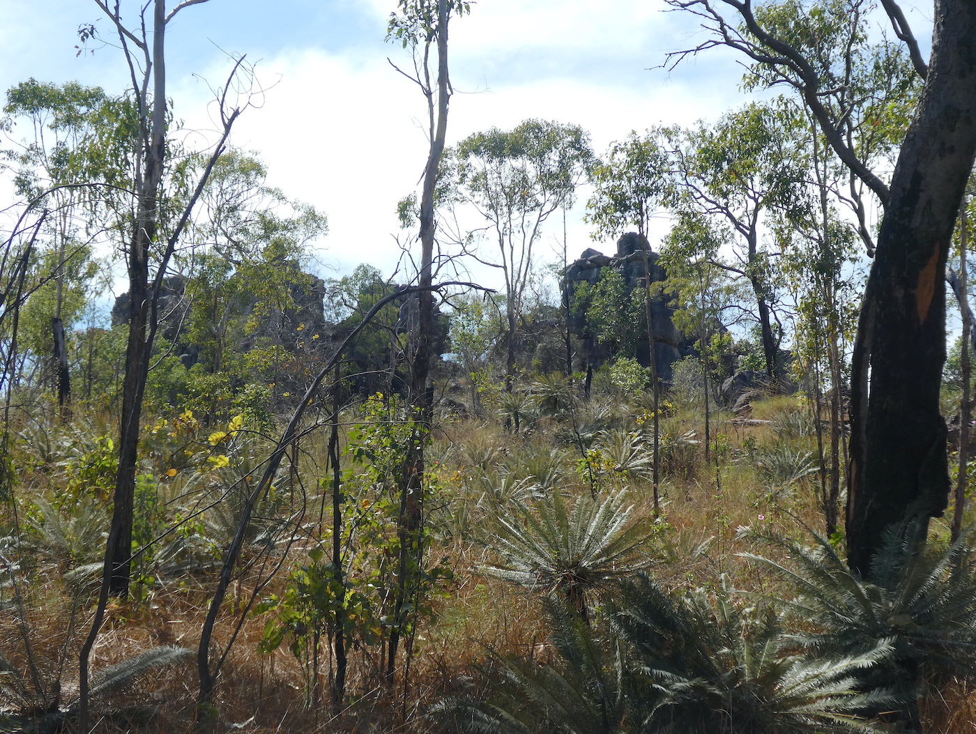
Feeling inspired by our Wangi Falls expedition, we ventured 10km further down the road to walk the 1.6km Tolmer Creek loop before lunch. The trail started with an easy amble along a flat path surrounded by scattered rock formations
and sporadic blooms of Sturt’s desert rose. The floral emblem of the Northern Territory, this delicate flower was named after the explorer Charles Sturt. Interestingly, the stylised version on the official flag has seven petals instead of five.
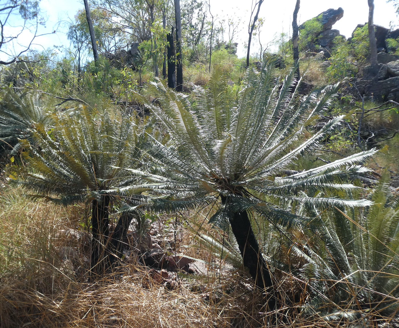
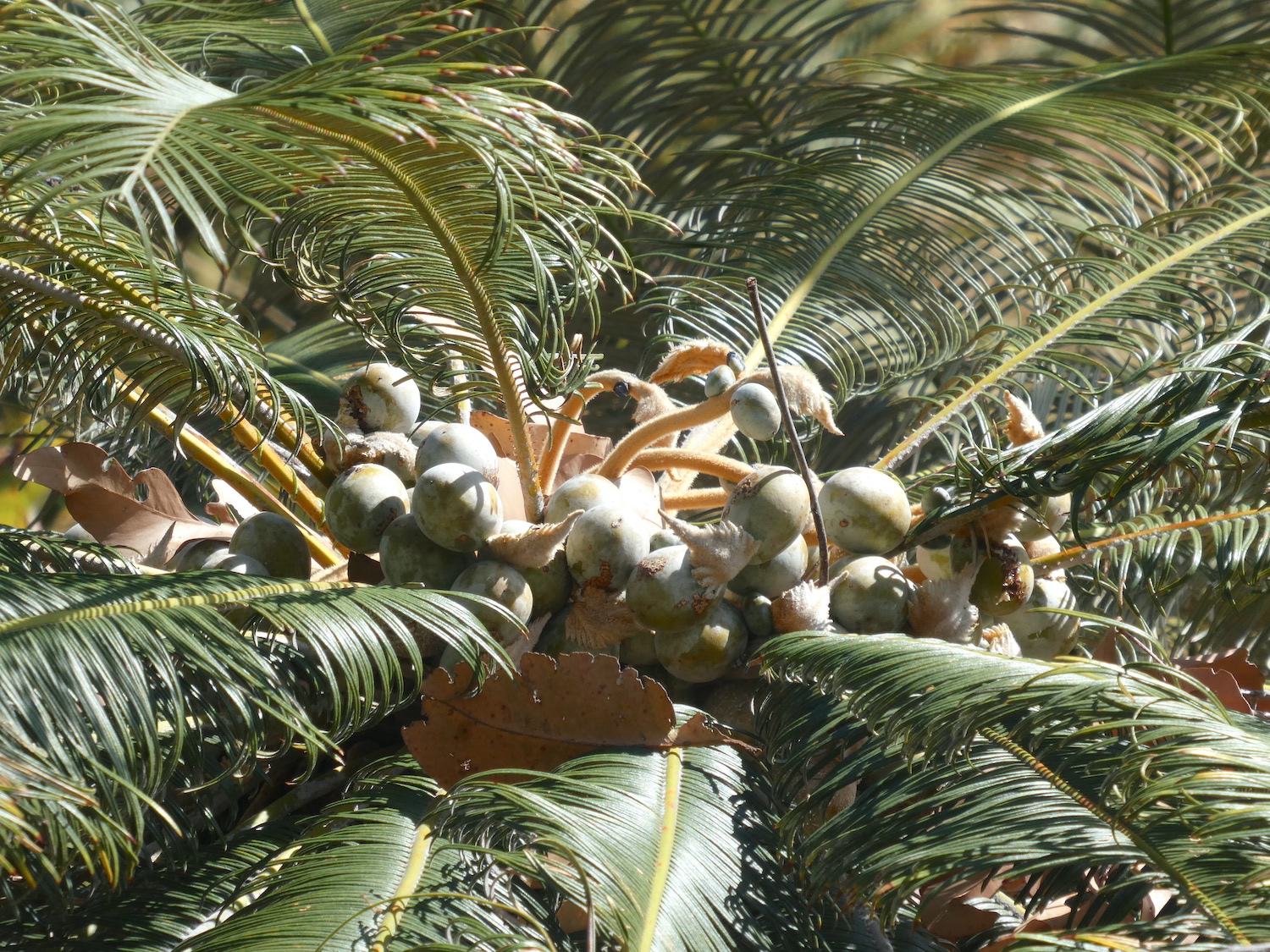
Hundreds of cycads dotted the prehistoric landscape.
The male plants grow a large, pollen producing cone on the top of the trunk but the females grow a cluster of stalks that grow upward until the seeds at the end get heavy and they droop. They are not recommended for a bush tucker menu as they contain a neurotoxin and are poisonous.
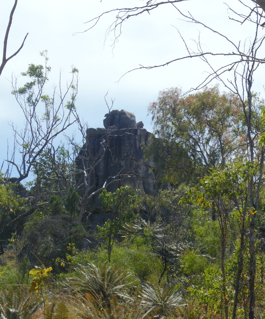
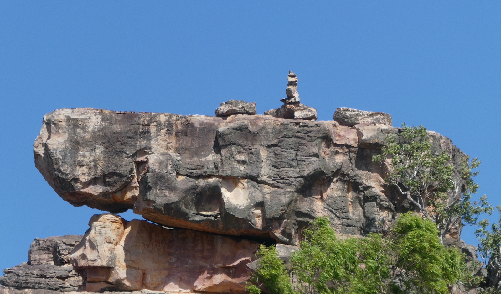
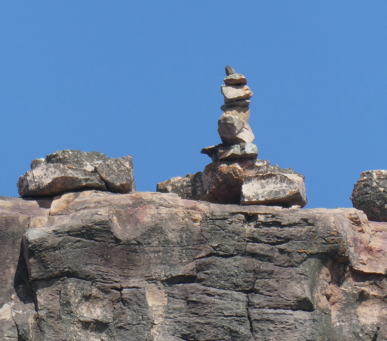
The track became steep and rocky as we neared the top of the falls, taking a moment to ponder some carefully constructed rock art.
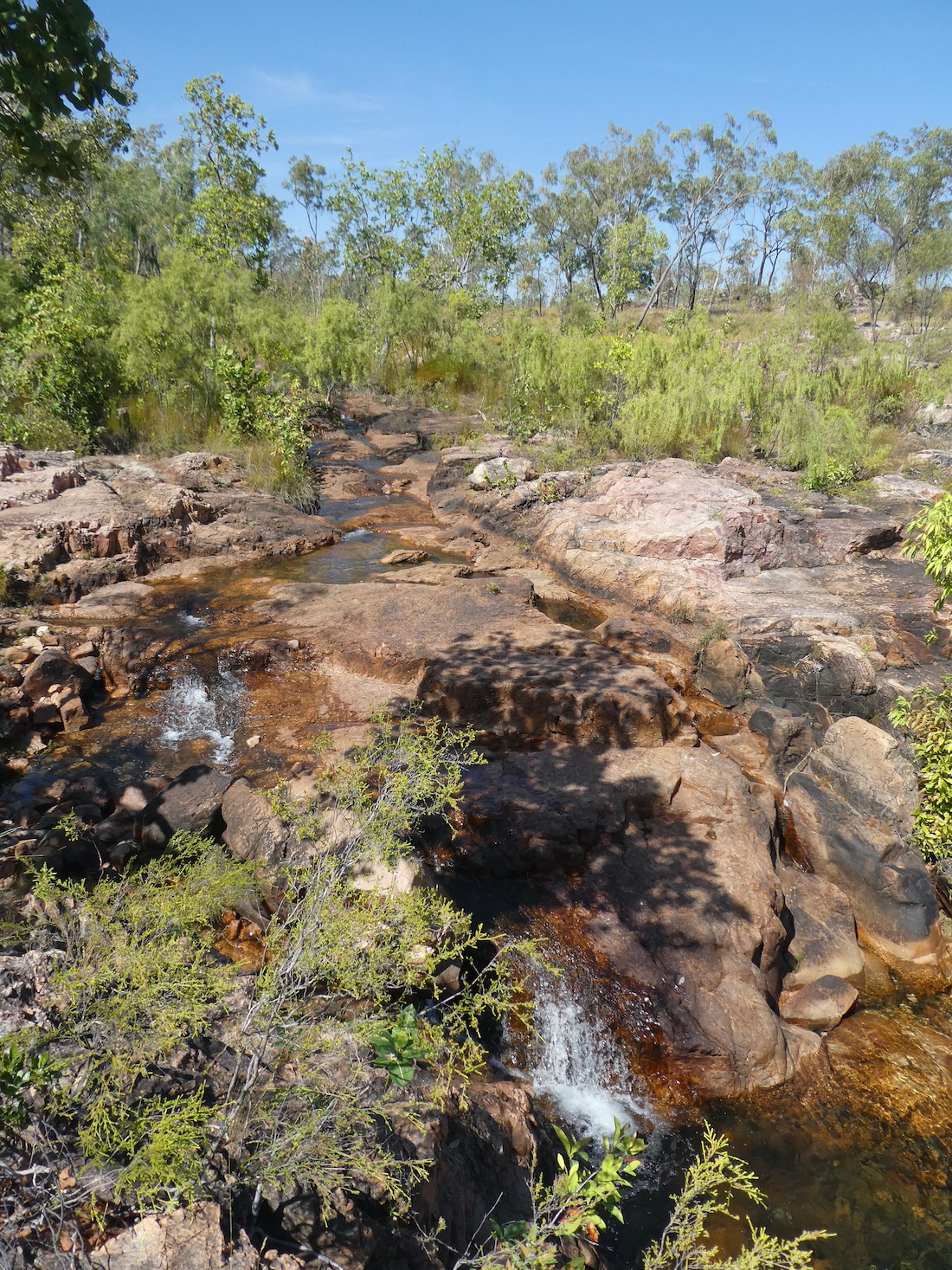
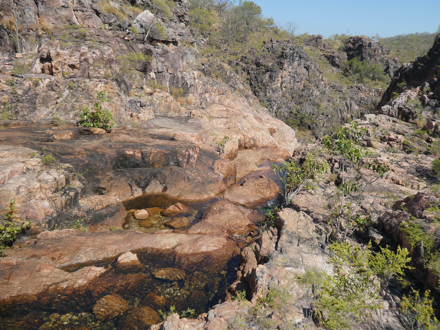
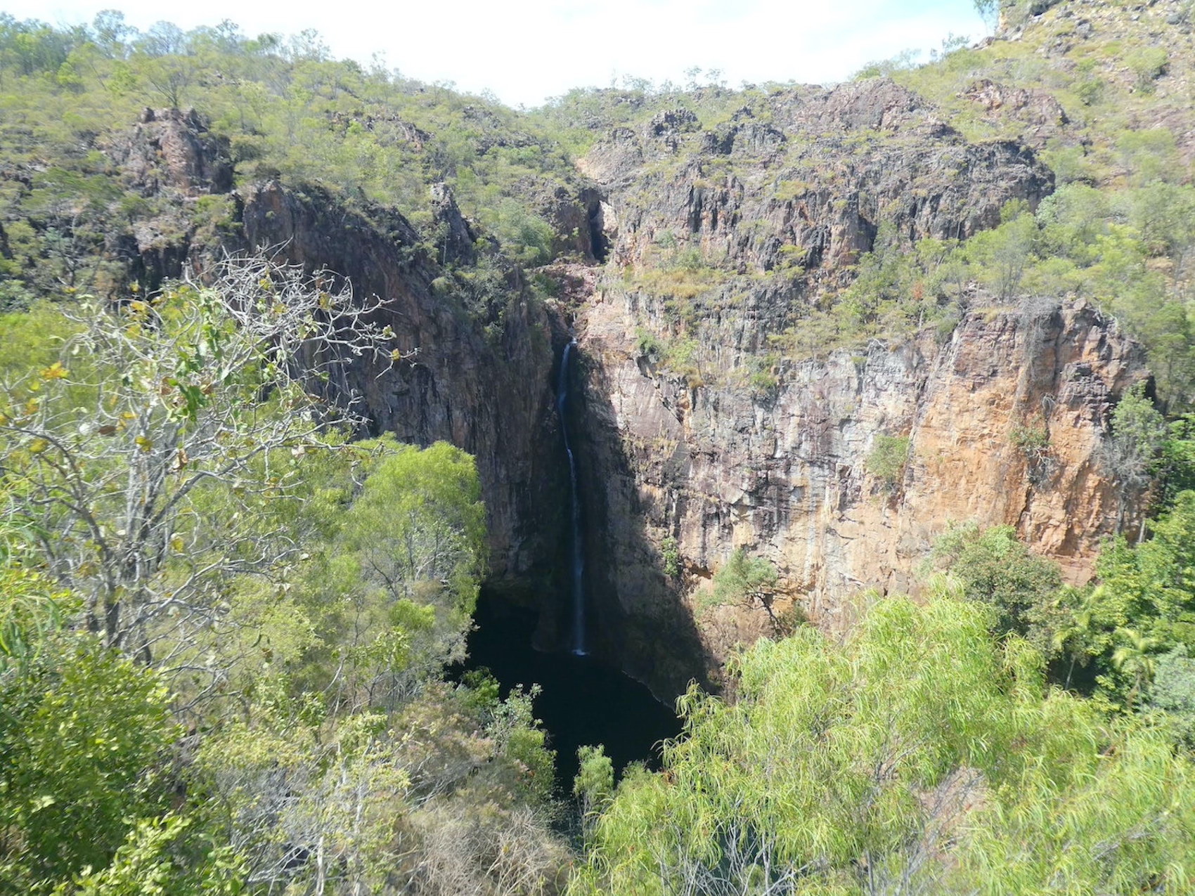
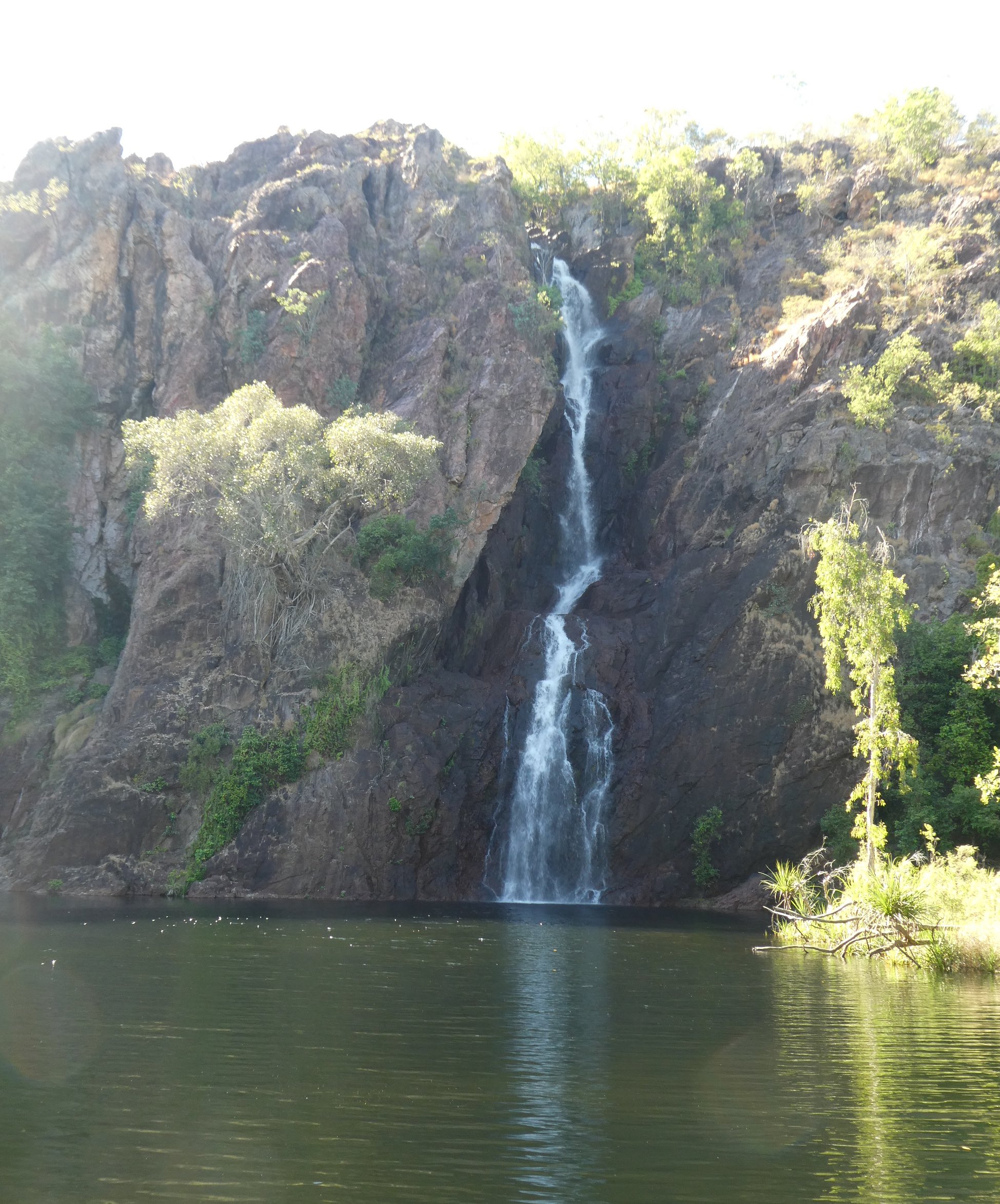
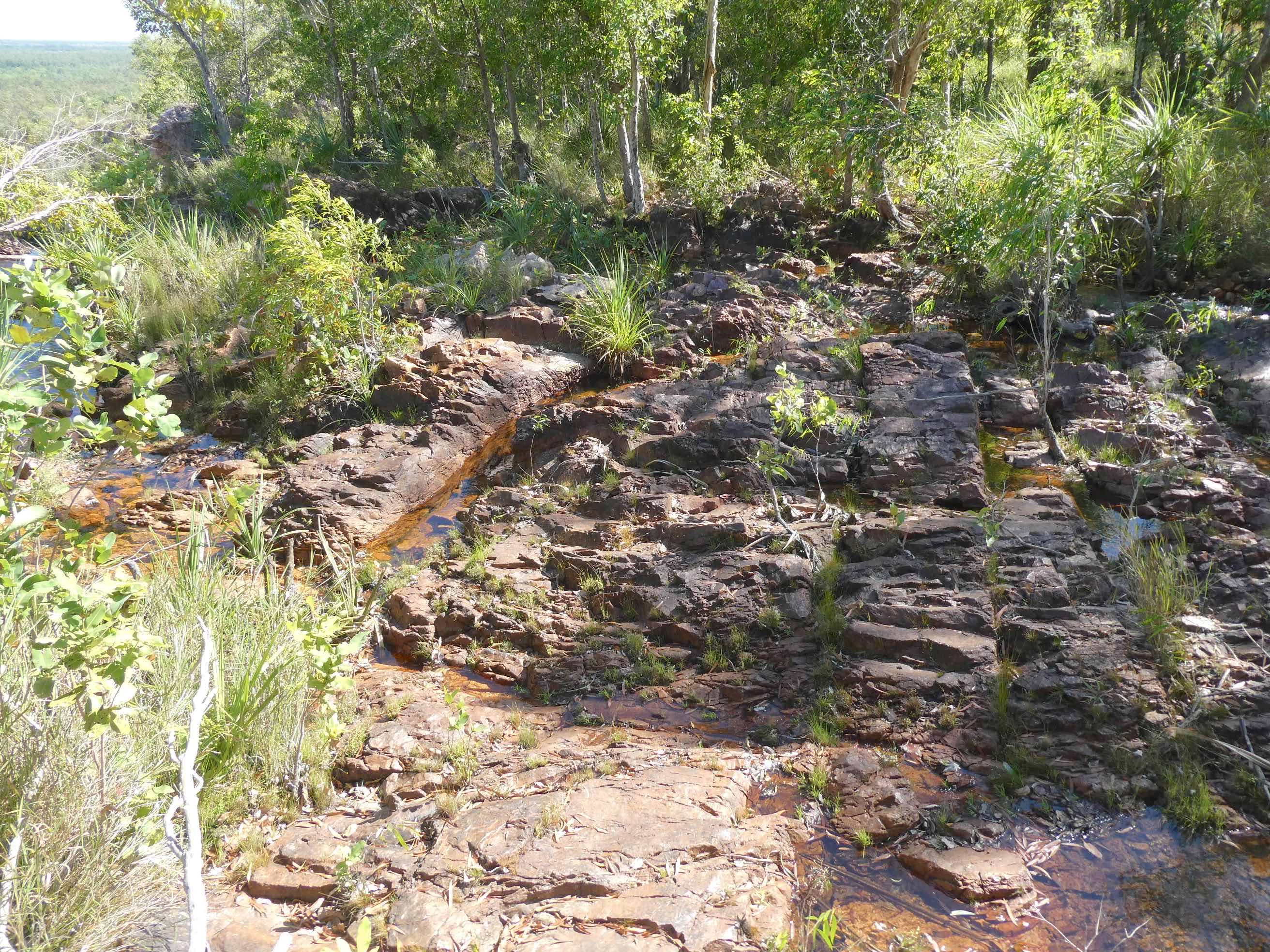
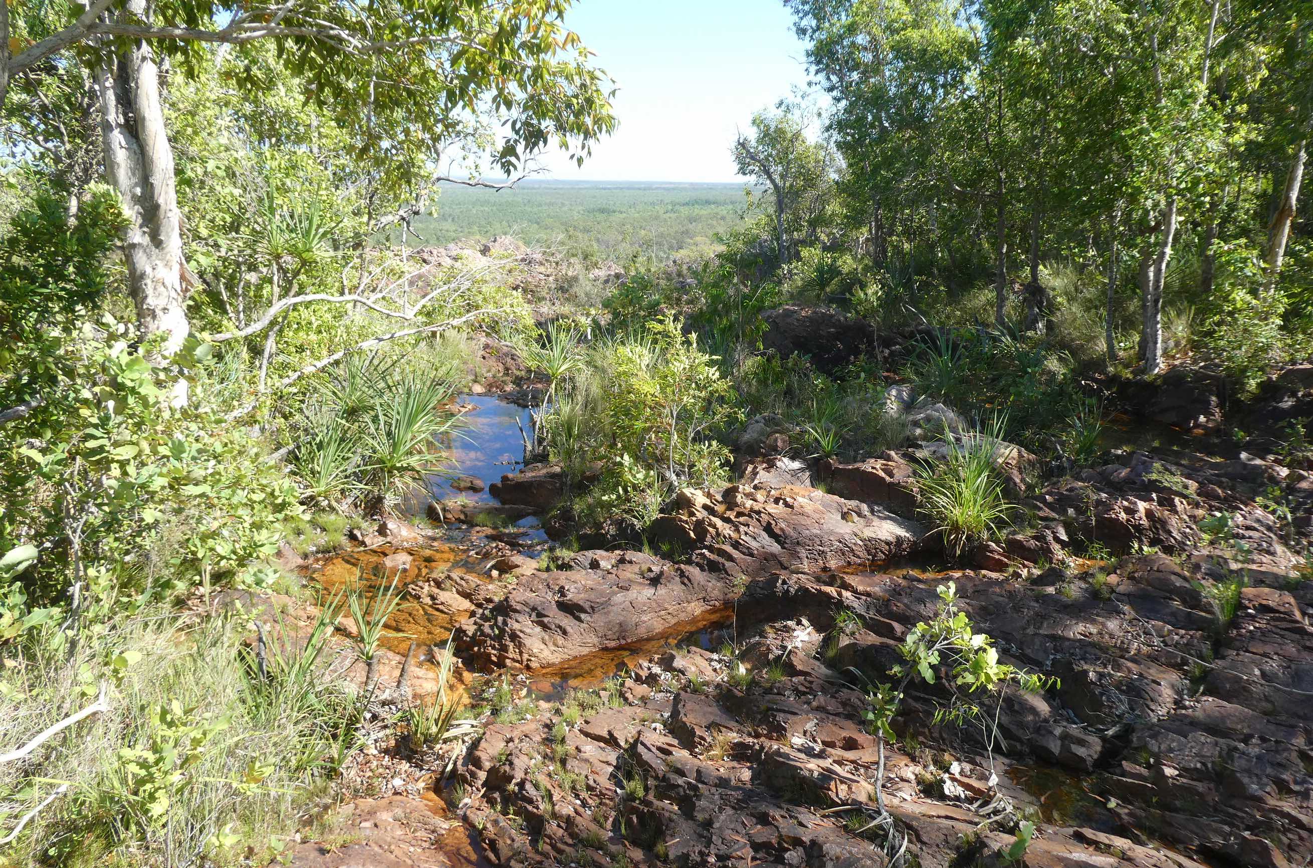
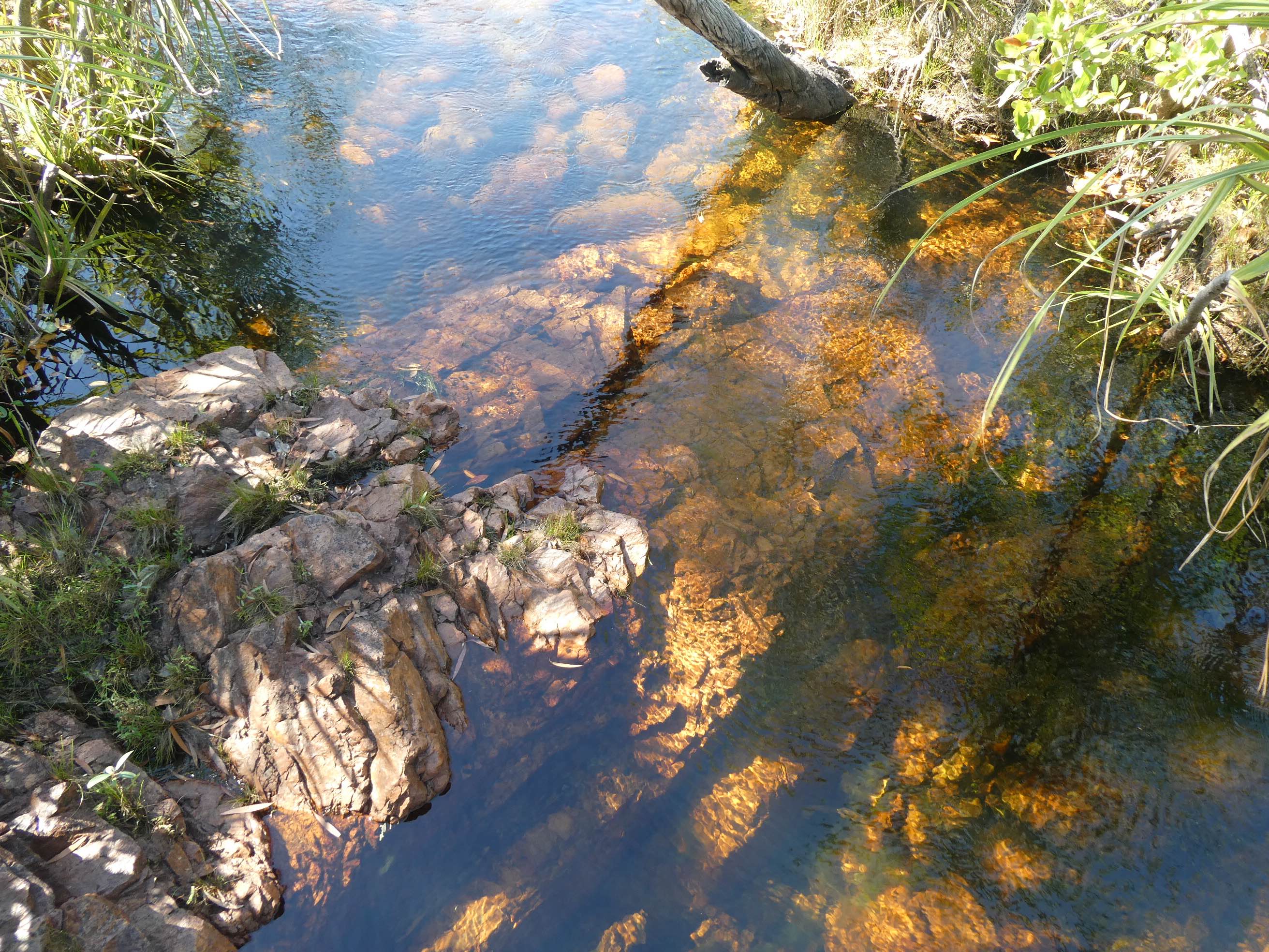
The crystal clear water of Tolmer Creek trickled its way over golden sandstone to the edge of the escarpment.
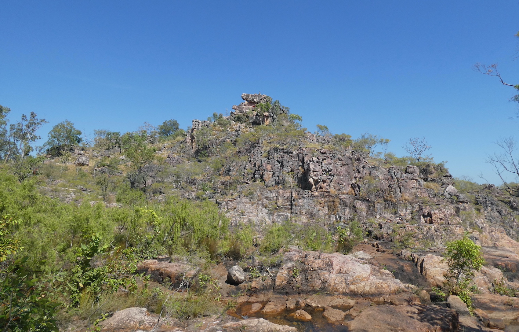
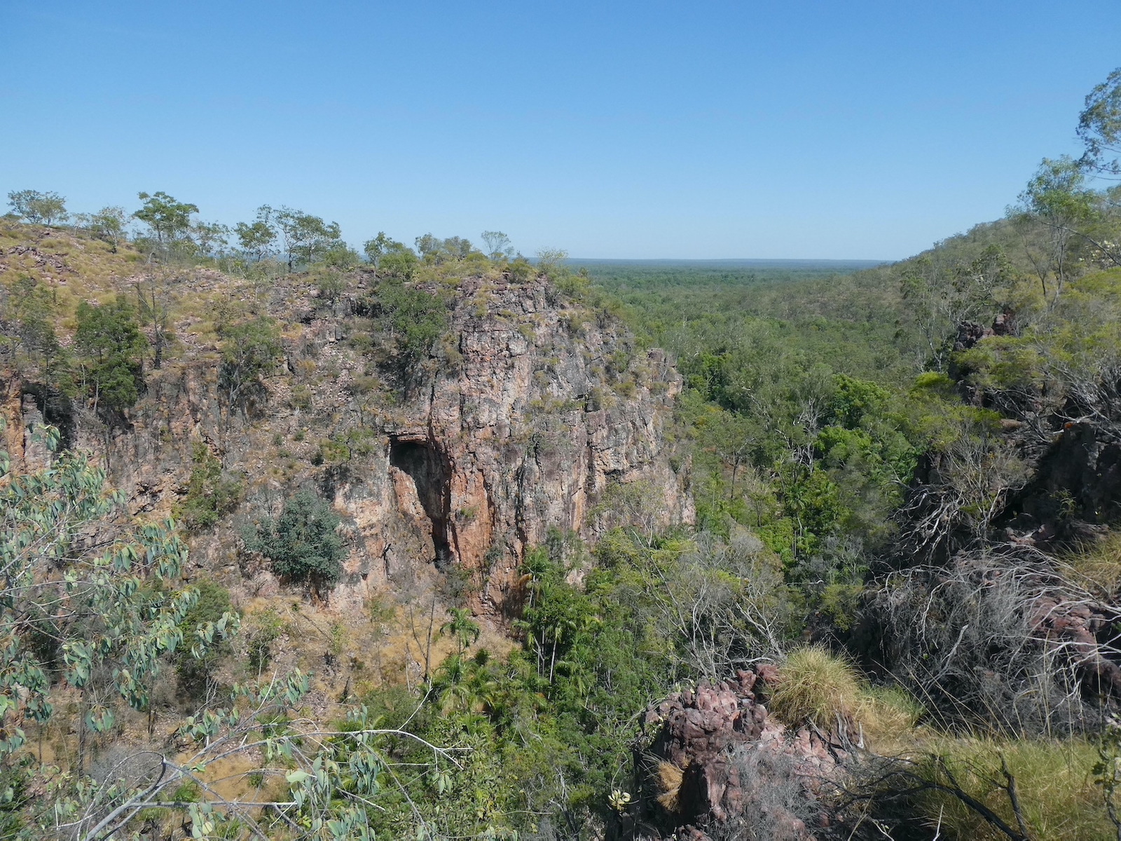
We were rewarded with awe-inspiring views and spectacular cliffs as we made our way to the viewing platform.
Explorer Frederick Henry Litchfield named the falls after his late father’s colleague in the South Australia Police, Alexander Tolmer. The water cascades over two high escarpments into a deep plunge pool where swimming is prohibited.
The panorama from the other side of the viewing platform was quite different but equally as impressive.
It is many years since I have been to Litchfield National Park and on my recent sojourn to Darwin, a visit was included on the agenda. Named after Frederick Henry Litchfield who explored the Northern Territory in the mid 1800s, the 1,500 square kilometre park is a comfortable 90 minute drive south of Darwin. The park has several stunning waterfalls and crystal clear swimming holes, the largest being Wangi Falls.
In 1883, surveyor David Lindsay named the falls after his youngest daughter, Gwendoline. Forty years later, Max Sargent took up the pastoral lease over the area and renamed the falls after his second daughter, Kathleen, who was born in 1954. The Townsend family took over the lease in 1961, built an outstation nearby and called it Wangi, the local aboriginal name for the area. Consequently, the falls became known as Wangi Falls. There are actually two cascades at Wangi, the morning sun wasn’t conducive to photographing the narrower stream flowing to the left of the main falls.
We set off on the Wangi Loop Walk, a 1.6 kilometre circuitous trail that climbs the escarpment to the top of the falls and returns on the other side of the pool. Colonies of flying foxes roosted above us, not bothering to seek shade for their morning slumber.
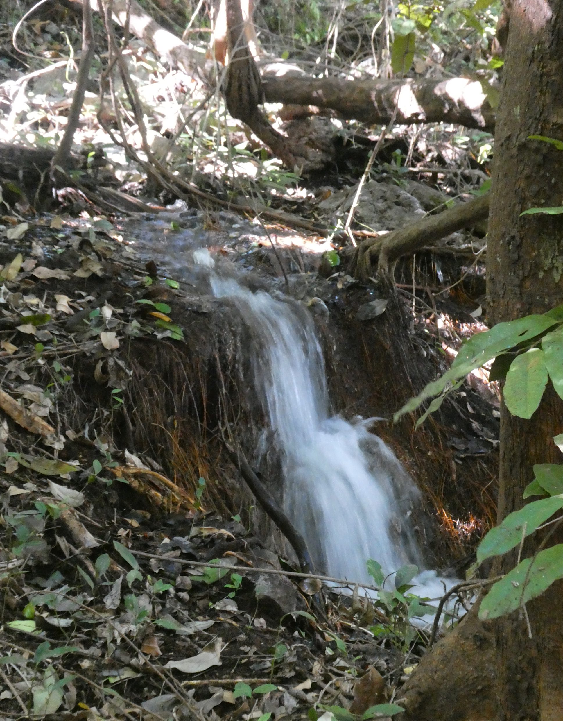
Meandering streams tumbled their way through the lush forest,
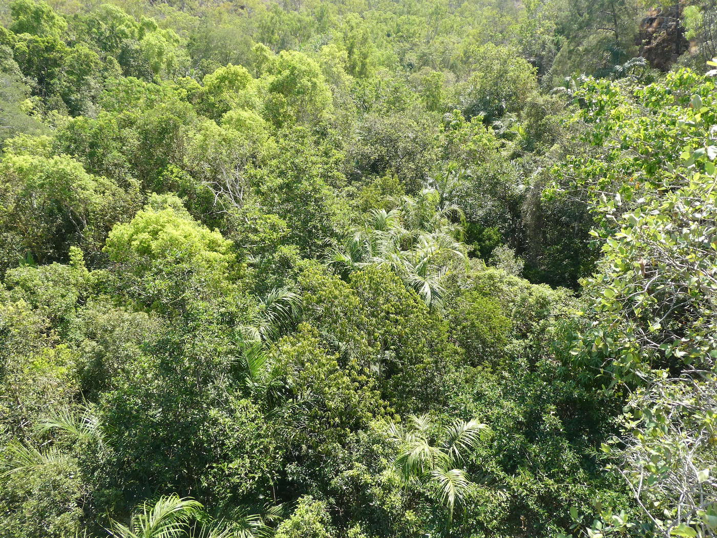
the canopy opened up to reveal a breathtaking vista as we neared the summit.
There is no view of the actual falls from the top and it is surprising that these trickling water courses create such a spectacle as they plummet over the cliff.
Smaller waterfalls accompanied us as we twisted and turned our way down a series of stone steps
to return to the pool for one last look at the majestic Wangi Falls.