Our trip to Pumphouse Point earlier this year gave us the opportunity to travel a road we hadn’t been before. Anthony Road, built as part of the Hydro Tasmania scheme, leaves the A10 five kilometres south of Tullah and reconnects just north of Queenstown. I had been advised by a work colleague to stop at Lake Plimsoll lookout for some spectacular views, it was very good advice.

In 1994, the Anthony River was dammed by the Hydro-Electric Commission and the 340 hectare lake was created.
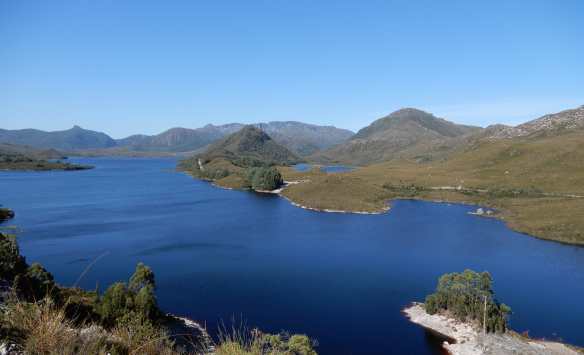
Named for Sir James Plimsoll, the Governor of Tasmania from 1982 to 1987, it was the last major dam constructed by the Commission.

Beyond the lake lies the Tyndall Range, an area marked by the course of glaciers in the last Ice Age. It seems fitting that it is named in honour of Irish physicist Professor John Tyndall, who had a special interest in glacier motion.

The sharp peaks of the range contrast with the gentle arch of Mount Tyndall, composed of Owen conglomerate from the Ordovician era, about 480 million years ago.

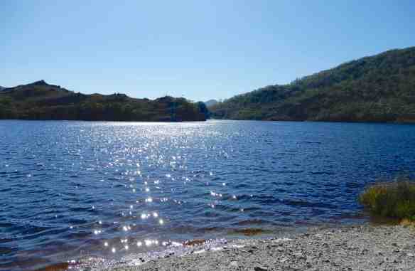
We wandered down to the water’s edge, the sunlight sparkled on the surface. Stocked with brook trout, the lake is a popular fishing spot. I can imagine spending a few hours afloat, though I prefer the company of a good book to a fishing rod.

So many beautiful treasures in Tassie ☺
LikeLike
Still so many we haven’t discovered yet.
LikeLike
Lovely spot 🙂
LikeLike
Might entice someone to Tassie to do some fishing? 🎣
LikeLike
Beautiful capture of a beautiful spot!
LikeLike
Thank you.
LikeLiked by 1 person